In the World
A growing photo log from research trips, library visits, and the field work behind the Kaufmann World Travel Factbook. The world is the source material; the books are the notes.
A few honest notes before you scroll. Across every journey pictured below, not one human was harmed, not one animal was eaten, and not one photograph contains anything indecent — just a man, a camera, and a stack of postcards heading home. 🙂 Your grandmother would approve.
“It always seems impossible until it’s done.”
— Nelson Mandela
The motto I travel by. I have tried to take it seriously.
🇪🇺 Europe15 photos · 6 countries
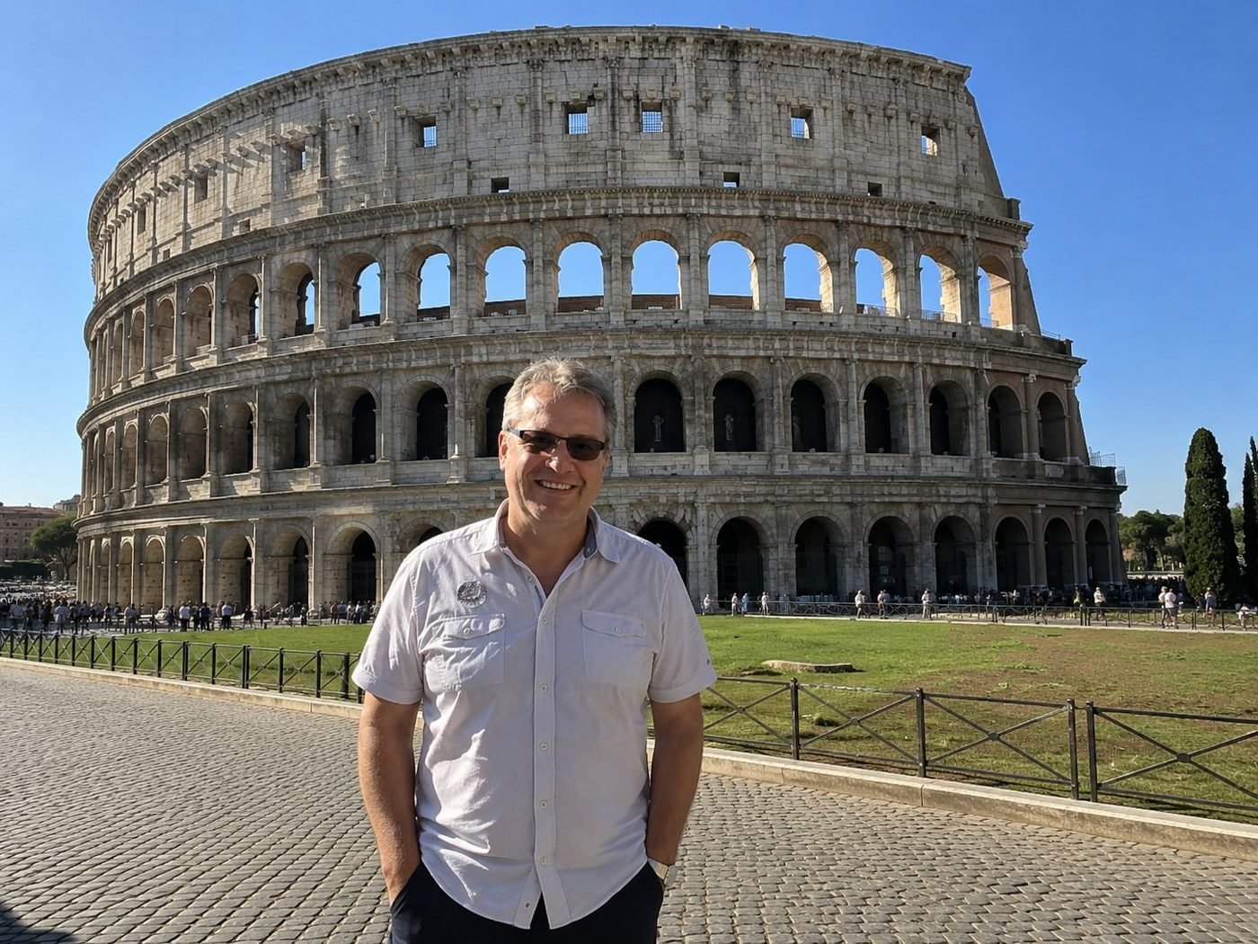
The Colosseum · the full façade
The Flavian Amphitheatre keeps winning the staring contest. In a city that produces saints and ruins in roughly equal measure, this one is older than the religion built around it — a stadium with the same brutal logic as Wembley or Yankee Stadium, retrofitted over fifteen centuries into something we mistake for sacred. The best view is from a slight rise on the Via Sacra side: enough distance to read the whole arc of the building, enough proximity to feel what eighty thousand seats actually meant in 80 CE.
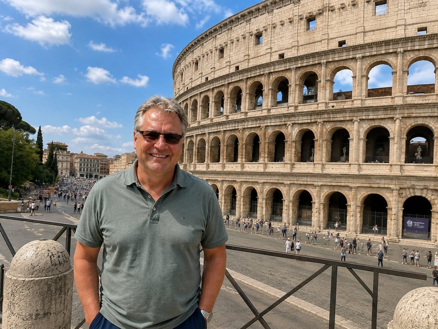
The Colosseum · arches and travertine
Up close, the engineering does the talking. Three orders of columns stack vertically — Doric, Ionic, Corinthian, in that exact order — not as decoration but as a load-bearing argument about hierarchy in stone. The whole façade is travertine, lime-rich stone quarried near Tivoli and brought in by a road built just for the project. You realise the marvel isn't that the building is here today. It's that it ever rose at all.
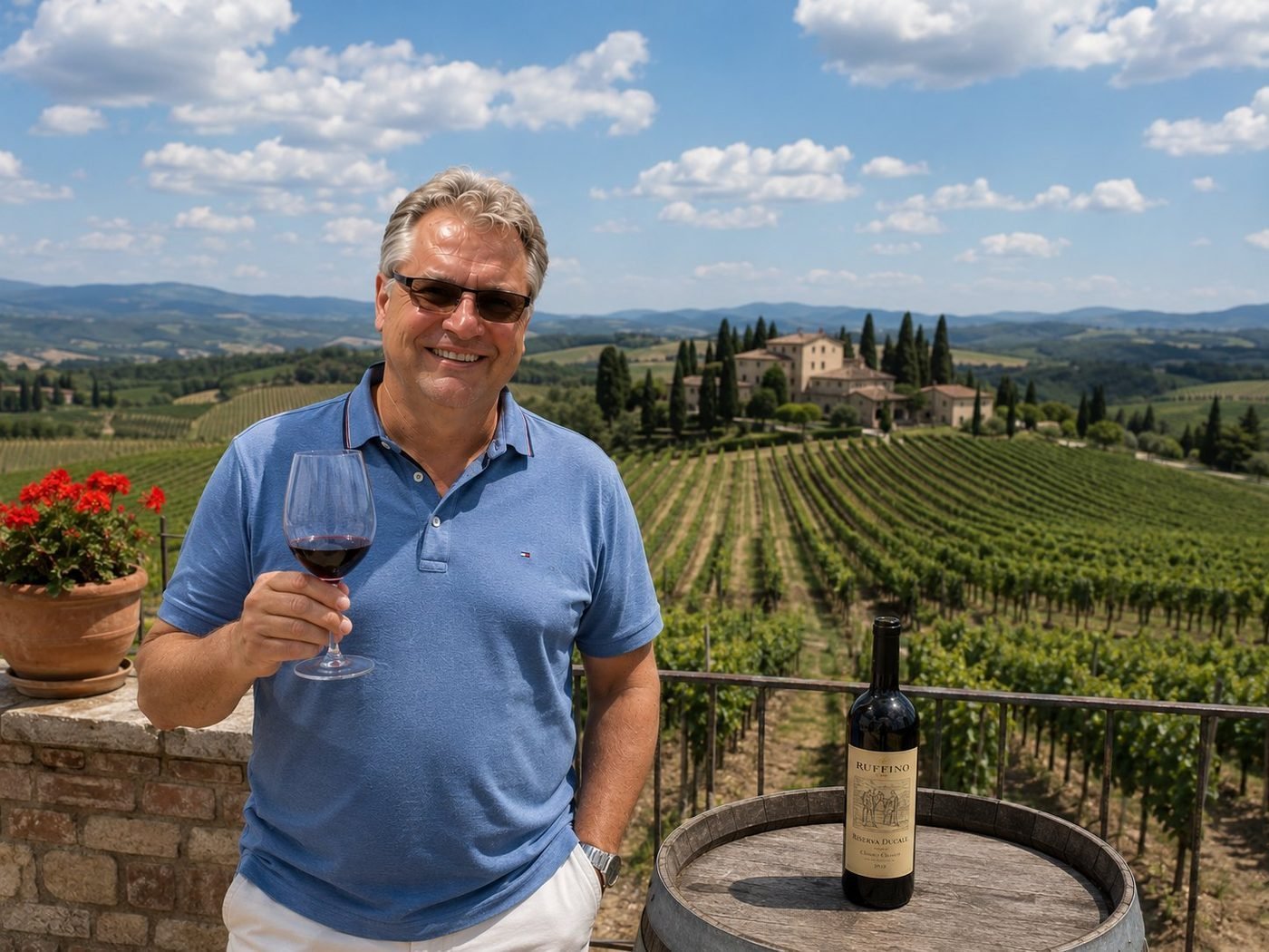
Chianti Country
Tuscan landscape is propaganda that turned out to be true. Cypress trees lining the ridge, a villa exactly where a villa should be, vines in straight lines down the slope — every cliché holds up when you arrive. The bottle on the table is a Ruffino Riserva Ducale, the Chianti Classico that helped invent the modern image of the region. I keep coming back, partly for the wine, partly to confirm that this place isn't an Instagram filter.
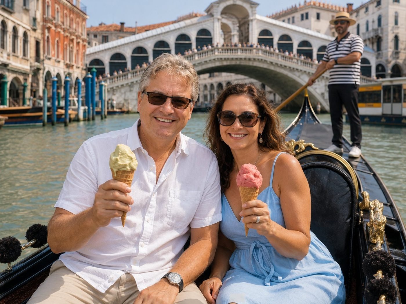
Gelato beneath the Rialto
Venice is a city built on the proposition that water might be a road, and 1,500 years later the bet is still paying off. Riding a gondola under the Rialto with two cones of gelato — pistachio and stracciatella — is the most touristy thing one can do here, and I refuse to apologise for it. The bridge has been carrying merchants across the Grand Canal since 1591. Today it carries selfie sticks. Both seem fitting.
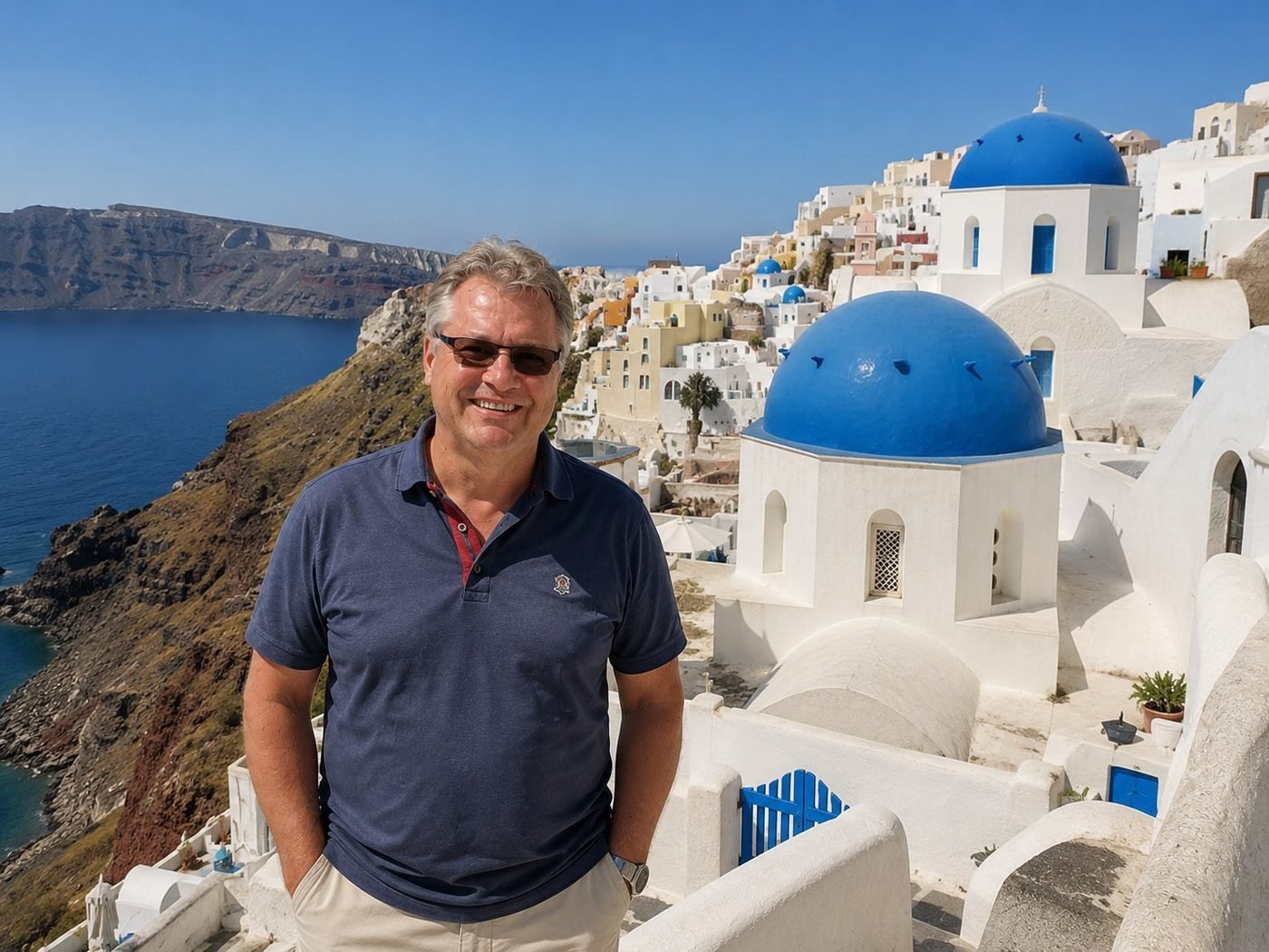
The Blue Domes of Oia
Oia is what happens when geology decides to assist tourism. The crescent of the Cyclades sits on the rim of a sunken volcano; the white village clings to the inside of the caldera; the blue domes started as a practical choice — cheap pigment, plenty of sun — and ended as a global brand. The view of Therasia across the water, on the right kind of late afternoon, is one of the small things in Europe genuinely worth flying for.
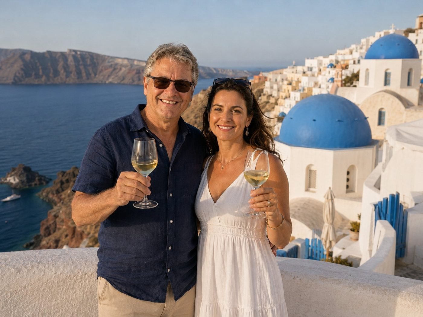
A Toast over the Caldera
Assyrtiko is the local white — a volcanic grape grown in basket-shaped vines kept low against the wind, with a salt-and-flint character that tastes like the rock it came from. Sunset toasts on Santorini are roughly twenty thousand a day in summer; we did ours quietly, before the crowd assembled on the cliff for the actual show. The view did the heavy lifting.
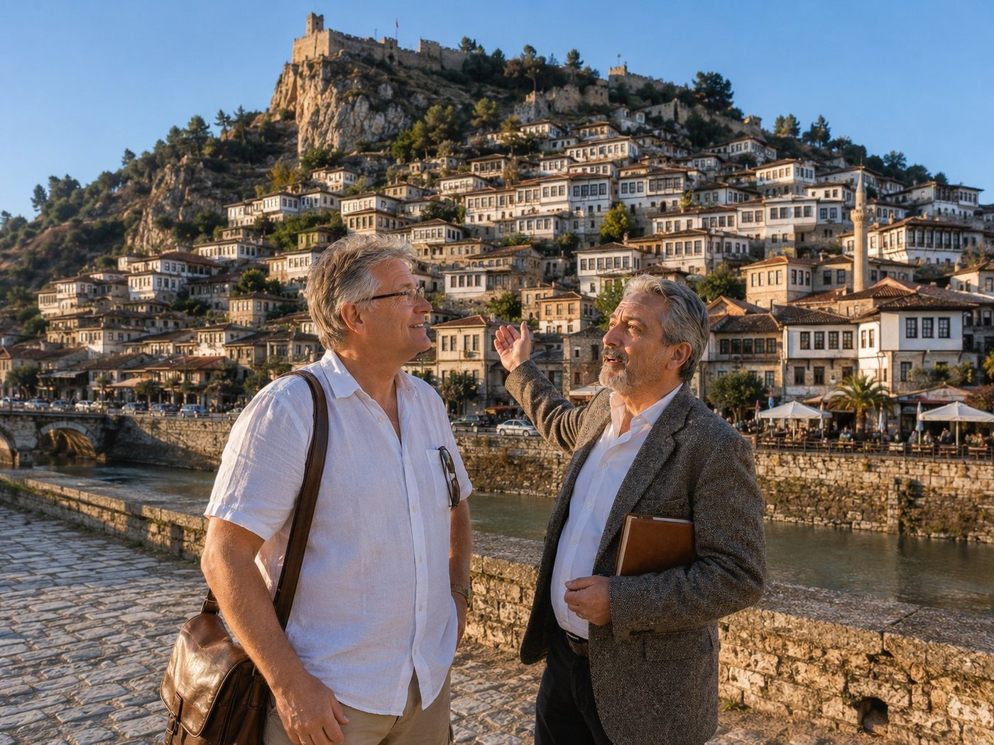
Berat · the Town of a Thousand Windows
Berat is a 2,400-year-old hilltop city in central Albania whose Ottoman-era old town clings to a steep slope above the Osum River in such dense tiers of whitewashed houses that the place earned its other name — Qyteti i Një Mijë Dritareve, the Town of a Thousand Windows. The windows aren’t just numerous; they’re a feature. Every house faces the same direction, every window stacks neatly above the one below, so the whole hillside reads as a single architectural composition. UNESCO listed it for that reason in 2008. At the top sits the 13th-century Berat Castle, one of very few inhabited medieval castles in Europe — people still live inside its walls. My guide that afternoon, Andrei, is an Albanian historian who has spent thirty years writing about the town. He showed me which house his great-grandfather built, which windows survived which war, which café serves the best bukë me djathë. Some places are best understood through the people who refuse to leave them.
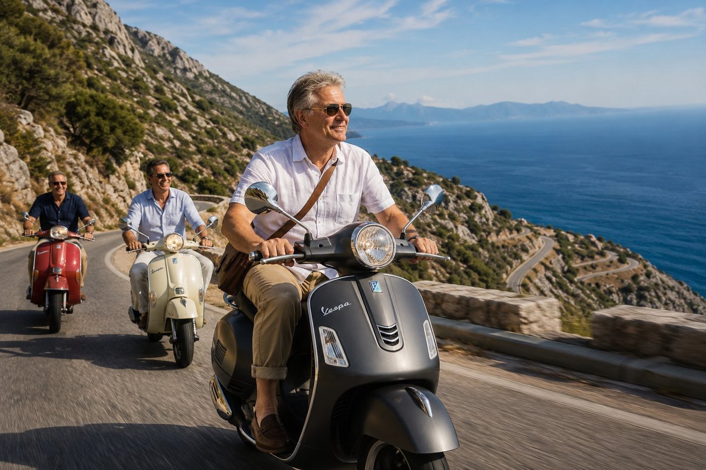
SH8 · the Albanian Riviera
SH8 runs the length of the Albanian Riviera, from the bay of Vlorë down through the Llogara Pass at 1,027 metres and on past Himarë, Dhërmi, and Sarandë to the Greek border. The pass climbs through Ceraunian Mountains so rugged the Ottomans gave up trying to govern this stretch of coast and let the villages run themselves. The descent from Llogara, hairpin after hairpin opening onto views of the entire turquoise coastline below, is — without exaggeration — one of the great drives in the Mediterranean. The road is empty. The light is gold. Corfu sits on the horizon, three kilometres off the Albanian shore, looking close enough to swim to. I rode this one in the company of Genti and Bardh, two friends from Sarandë who treat SH8 like the family driveway. They were generous enough to let me lead. They were faster than they looked.
Espresso in Blloku
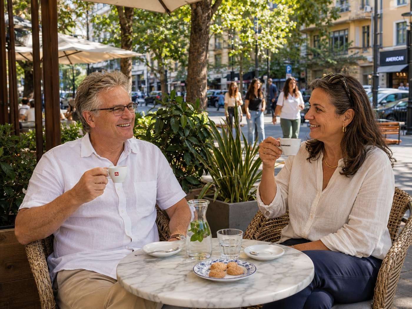
Until 1991, Blloku was the most exclusive square kilometre in Albania — the closed-off neighbourhood where Enver Hoxha and the Communist Party elite lived, eight blocks of leafy streets and modernist villas walled off from the rest of Tirana. Ordinary Albanians weren’t allowed in. After the regime fell, the walls came down, the villas were turned into bars and boutiques, and within a decade Blloku had become the hippest neighbourhood in the Balkans — a place where the children of Communist commissars opened cocktail bars next to the children of dissidents who’d been sent to gulags. Albania, in a single neighbourhood, working through its history with cheerful pragmatism. Mira, my friend from a Tirana publishing house, has been writing essays about the transformation since the 1990s. We drank the small ferocious espressos that Albanians prefer, and she told me which buildings had been which official’s villa, which villa had been which secret-police office. Some histories take a generation to talk about. Others, you can cover in an hour and a half over good coffee.
Ksamil · Kayak Between the Islands
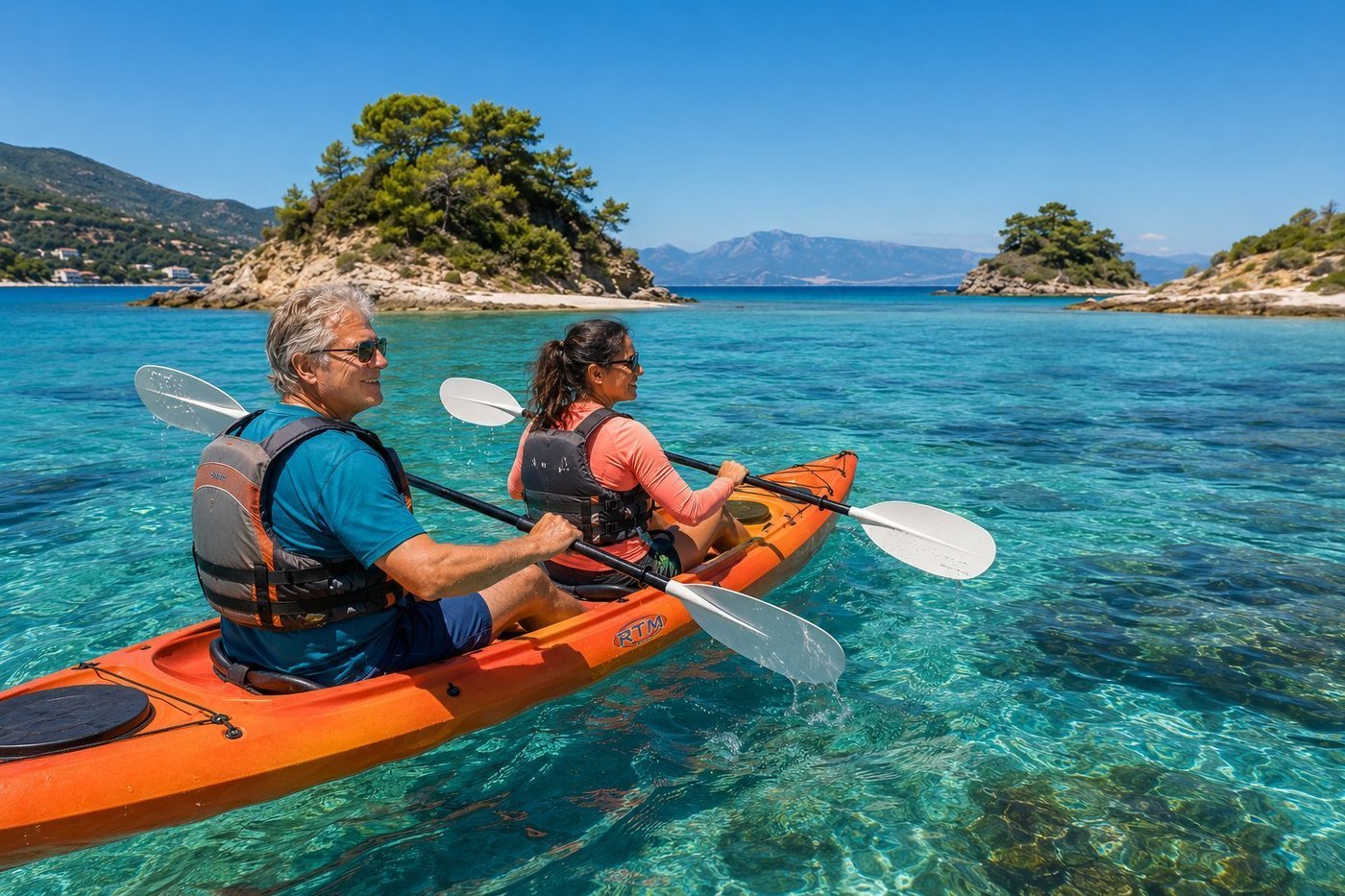
Ksamil is a village at the southern tip of the Albanian Riviera, three kilometres across the Vivari Channel from Corfu and as far from a city as you can get in this country. Three small uninhabited islands lie within easy paddling distance from the shore — green tufts of Mediterranean pine and wild oregano rising from water so clear it doesn’t look real. The Ionian here is 25 degrees in summer; the islands have tiny crescents of pebble beach that, if you arrive before ten in the morning, you can have to yourself. The economic miracle of post-Communist Albania has done much of its work on this coast. Twenty years ago Ksamil was a half-empty village whose teenagers all wanted to leave for Greece. Today it’s where the children of those teenagers come back to run beach bars and seafood restaurants. Klara, who lent me the kayak and paddled in the bow seat, runs one of those restaurants. She knew the water the way her grandmother knew the kitchen — completely, without thinking. I tried to keep up.
Auracher Löchl · below the Fortress
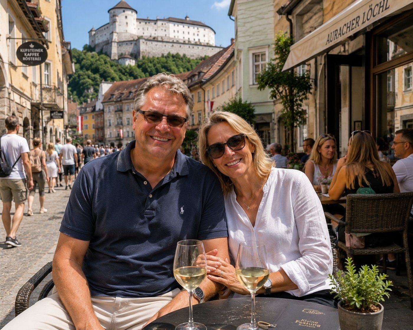
Auracher Löchl has been pouring drinks since 1480 — about a century before Shakespeare wrote anything. The fortress on the cliff above it, Festung Kufstein, is older still, dating from 1205. The Tyrol works because the medieval logic of the place — castle on the rock, town in the gorge, river to power the mills — never stopped making sense. You sit in a courtyard restaurant under the same shadow that fell on it in 1480, and the wine list is, by some miracle, still excellent.
Schönbrunn Palace at Golden Hour
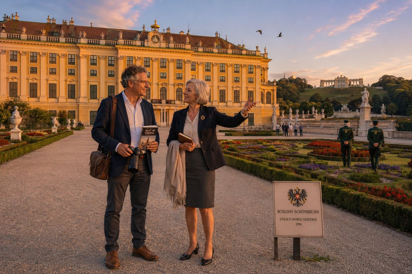
Schönbrunn — the Habsburg summer residence on the western edge of Vienna — has 1,441 rooms, a 435-hectare formal garden, the oldest zoo in continuous operation in the world (founded 1752), and a specific shade of warm yellow paint that Empress Maria Theresia chose in 1740 and that has been carefully reproduced on every Habsburg public building from Bregenz to Lviv ever since. It is called Maria-Theresien-Gelb — Maria Theresa’s yellow — and it is calibrated to look its best in exactly the late-afternoon golden light of a continental European autumn evening. The palace was the principal childhood home of Marie Antoinette (who left it at fifteen, never to return, to marry the future Louis XVI). It was the site of the 1814-1815 Congress of Vienna, which redrew the map of post-Napoleonic Europe. It was the favourite residence of Emperor Franz Joseph, who was born in this palace in 1830 and died in this palace in 1916, having reigned for sixty-eight years over an empire of fifty million subjects across thirteen modern-day countries. And it was, on the 11th of November 1918, the building from which the last Habsburg emperor, Karl I, formally renounced participation in affairs of state and ended a dynasty that had ruled central Europe in unbroken male succession since 1273. Dr. Friederike Hofmann walked me out into the central parterre an hour before closing, when the late tourist crowds have thinned and the light is at its most flattering to the architecture. She pointed out the specific window of the central facade on the second floor: the bedroom in which Franz Joseph slept on an iron camp-bed every night of his sixty-eight-year reign, refusing the silk-canopied imperial four-poster because, he said, it was undignified for the Emperor to live more comfortably than his soldiers. “In Vienna,” she said quietly, “we are still the most reluctant of all the republics. We had monarchy for six hundred years. We have been a republic for one hundred and eight. Some of us are still making up our minds.”
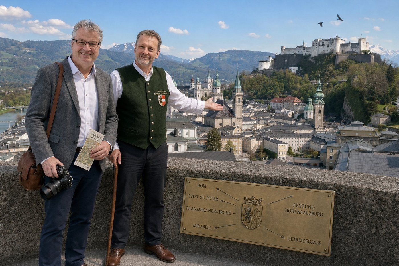
Salzburg Old Town from the Mönchsberg
Salzburg is the most architecturally intact historic city centre in the German-speaking world — 1.3 square kilometres of medieval, Renaissance, and Baroque buildings that survived the Second World War almost unscathed and have been continuously inhabited and used since the eighth century. The whole old town was inscribed as a UNESCO World Heritage Site in 1996. The city’s name is salt-town — Salz Burg — and salt is the reason it exists. The Romans mined it from the Dürrnberg salt deposit beginning around AD 80; the medieval Prince-Archbishops of Salzburg controlled the salt-roads (Salzstrassen) running from the Alps to Bavaria and Bohemia for almost a thousand years; the entire baroque rebuilding of the city centre in the 17th century was financed by salt revenues funnelled directly into the personal fortune of three successive Prince-Archbishops. Their Italian-trained court architects gave Salzburg the dense cluster of green-domed churches, Italian-style arcaded courtyards, and the unmistakable warm-yellow palette that makes the city look, from this viewpoint, like a single coherent piece of seventeenth-century architecture. In the middle of all this, in a narrow merchant’s house at Getreidegasse 9, on the 27th of January 1756, Wolfgang Amadeus Mozart was born. His father Leopold was a court musician to the Archbishop. Mozart spent the first twenty-five years of his life in this city, hated most of it, finally left in 1781 for Vienna, and never came back. The city has been politely competing with that fact ever since. Maximilian Berger took me up to the Mönchsberg viewpoint just after the Cathedral bells had struck eleven. He pointed out, with the amiable specificity of a man who has been giving the same tour for thirty years, the exact rooftop of the Mozart birthplace down in the Getreidegasse; the bell-tower of the Stiftskirche St. Peter, which has been rung continuously since AD 696; and the bunkered fortress of Hohensalzburg above us, which has never in nine hundred and forty-eight years been successfully taken by an attacking army. “What you are looking at,” he said with quiet pride, “is the most expensive, most beautiful, and most stubborn small city in central Europe. We are at the geographic centre of nothing in particular. We just decided, six centuries ago, to make this one place look exactly the way we wanted it to. And then we never stopped.”
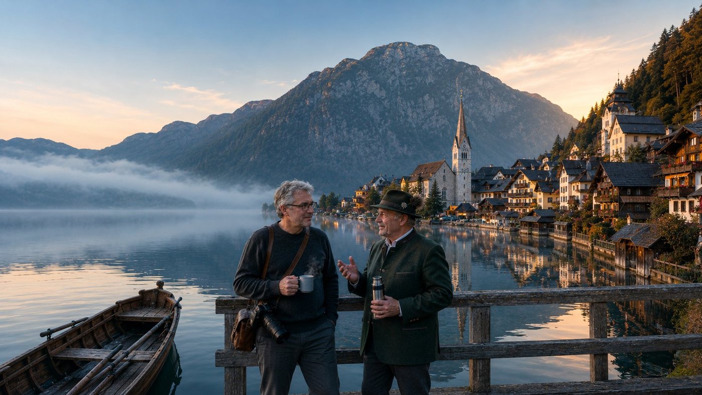
Hallstatt at Dawn
Hallstatt is what happens when seven hundred and fifty people decide, with great patience and considerable stubbornness, to keep living on a strip of lakeshore approximately one street wide, pressed between a glass-still alpine lake and a vertical mountain wall, for the better part of seven thousand years. The salt is the reason. The Hallstatt salt mine on the mountain above the village — the Salzberg, the salt mountain — is the oldest continuously worked salt mine on earth; archaeologists have dated wooden mining equipment from its galleries to around 5000 BC. The salt was the wealth, the salt was the trade, the salt funded everything. In the eighth century BC the village had grown rich enough on salt that its inhabitants began burying their dead with imported bronze cauldrons, amber from the Baltic, and carved ivory from North Africa. When the cemetery was excavated in the nineteenth century by a local mine official named Johann Georg Ramsauer, the grave goods were so unusual and so culturally distinct that European archaeologists invented an entire historical period to describe them: the Hallstatt Culture, 1200 to 500 BC, the early Iron Age of central Europe. Every textbook on Iron Age Europe still uses the name. The village that named the age is, today, six hundred metres long. Lukas Pömer is the ninth generation of his family to work the salt mine. He met me at the dock at six in the morning with a thermos of black coffee and a chamois-beard brush in his hat-band, both inherited from his grandfather. “We were here before Rome,” he said, looking out at the lake. “Before the Celts had a word for iron. The Hallstatt culture — they named the European Iron Age after this village, did you know that? Because of what they dug up in our cemetery.” A church bell struck the hour from somewhere above the rooftops, and the sound travelled across the mirror of the lake and came back to us a moment later, slightly altered. “It is a small place,” Lukas said. “But it has been small for a very long time.”
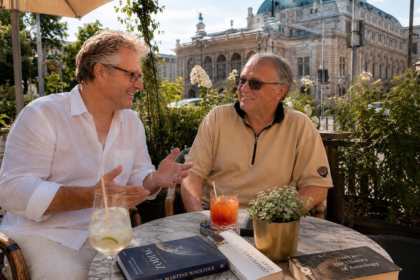
A Vienna Afternoon · Aperol, Hugo, and the History of Astrology
Vienna, the first warm afternoon of June, the back terrace of a café on the Universitätsring with the Burgtheater rising behind the rose bushes — Aperol Spritz, Hugo, and Bernhard Mann, who has just brought to the table three of the best-illustrated books on the history of astrology I have ever seen and is mid-sentence about the precession of the equinoxes. Bernhard is one of those Viennese intellectuals — there are still a few — who treats the entire span of Western thought as a single ongoing dinner-party conversation that he happens to have been invited to in 1969 and has not yet left. We have been arguing, in the friendliest possible way, about whether the Babylonians or the Egyptians ought to get credit for the twelve-fold zodiac (Bernhard: Babylonians, “and not even close”); whether Kepler’s Harmonices Mundi of 1619 is the last great astrological treatise or the first great astronomical one (“both, and it is exactly that which makes it interesting”); and whether the entire Western enterprise of trying to predict a human life by looking at the sky is more poignant if you believe it works or if you do not (we disagreed about this and ended in laughter). The Spritz is doing what the Spritz is supposed to do. The Burgtheater is doing what the Burgtheater has done since 1888 — looking heavier than the air around it and slightly older than it ought to be. “In Vienna,” Bernhard said at one point, “we have a very long tradition of taking ideas more seriously than people. It is one of our virtues, and it is also why we have produced more brilliant misanthropes per square kilometre than any other city in Europe. I include myself in this.” He smiled. “Cheers.”
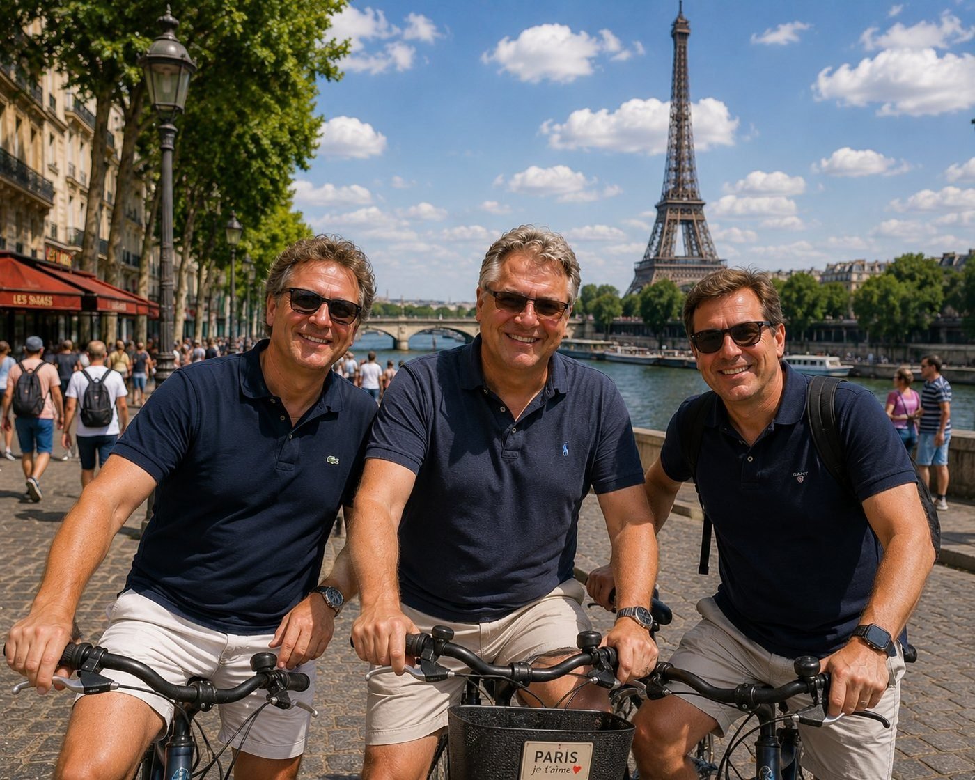
The Eiffel Tower · along the Seine
Paris is most itself at bicycle pace. The Seine path between the Champ-de-Mars and the Trocadéro gives you the Tower at every angle the postcards covered, plus a few they missed. The “PARIS je t’aime” sign on the basket is, of course, cheesy. So is Paris. That’s part of the deal — the city is too aware of itself to pretend otherwise, and embraces it with such elegance that you forgive it everything.
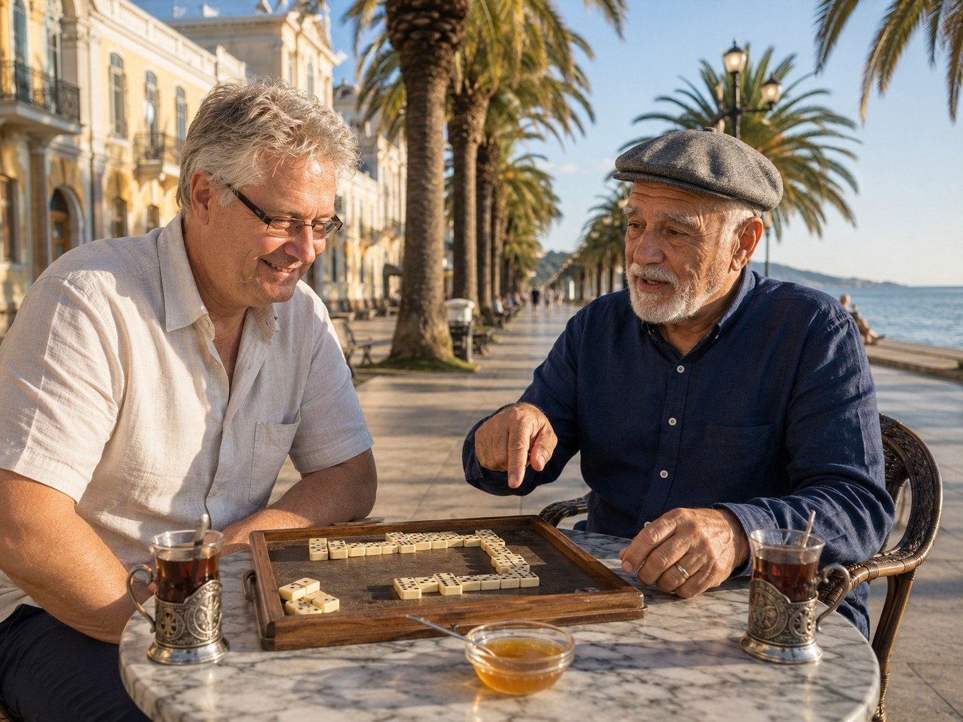
Dominoes on the Sukhumi Promenade
Sukhumi spreads along a crescent bay where the Caucasus meets the Black Sea — a city of faded elegance whose twentieth century put it through more than its share of trials. The Greeks knew it as Dioscurias in the sixth century BCE; the Soviets turned it into a resort capital where three million holidaymakers a year filled the sanatoriums; the 1992 war ended most of that. What survives is the rhythm of small things. The Botanical Garden, founded in 1840, still blooms with five thousand species. The palm trees still cast their evening shadows on the marble promenade. And at the seaside cafés, the older Abkhaz men still play dominoes the way they always have — slowly, seriously, over glasses of black tea sweetened with mountain honey. Aleko, my opponent that afternoon, was about to win, and was being kind enough to tell me how, before he did.
🌎 Americas21 photos · 8 countries
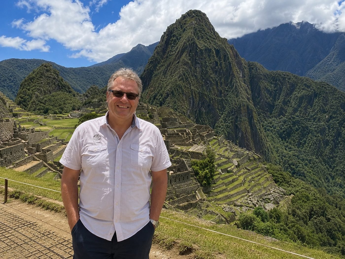
Machu Picchu · Huayna Picchu peak
The Inca built about three hundred kilometres of mortarless stone walls across this ridge — at 2,430 metres, in a climate that swings between cloud and equatorial sun within an hour. They did it without iron tools or the wheel. The site was “rediscovered” in 1911 by Hiram Bingham, though local farmers had been living next to it the whole time. Standing here, the first thing you notice isn’t the engineering. It’s how quiet it is.
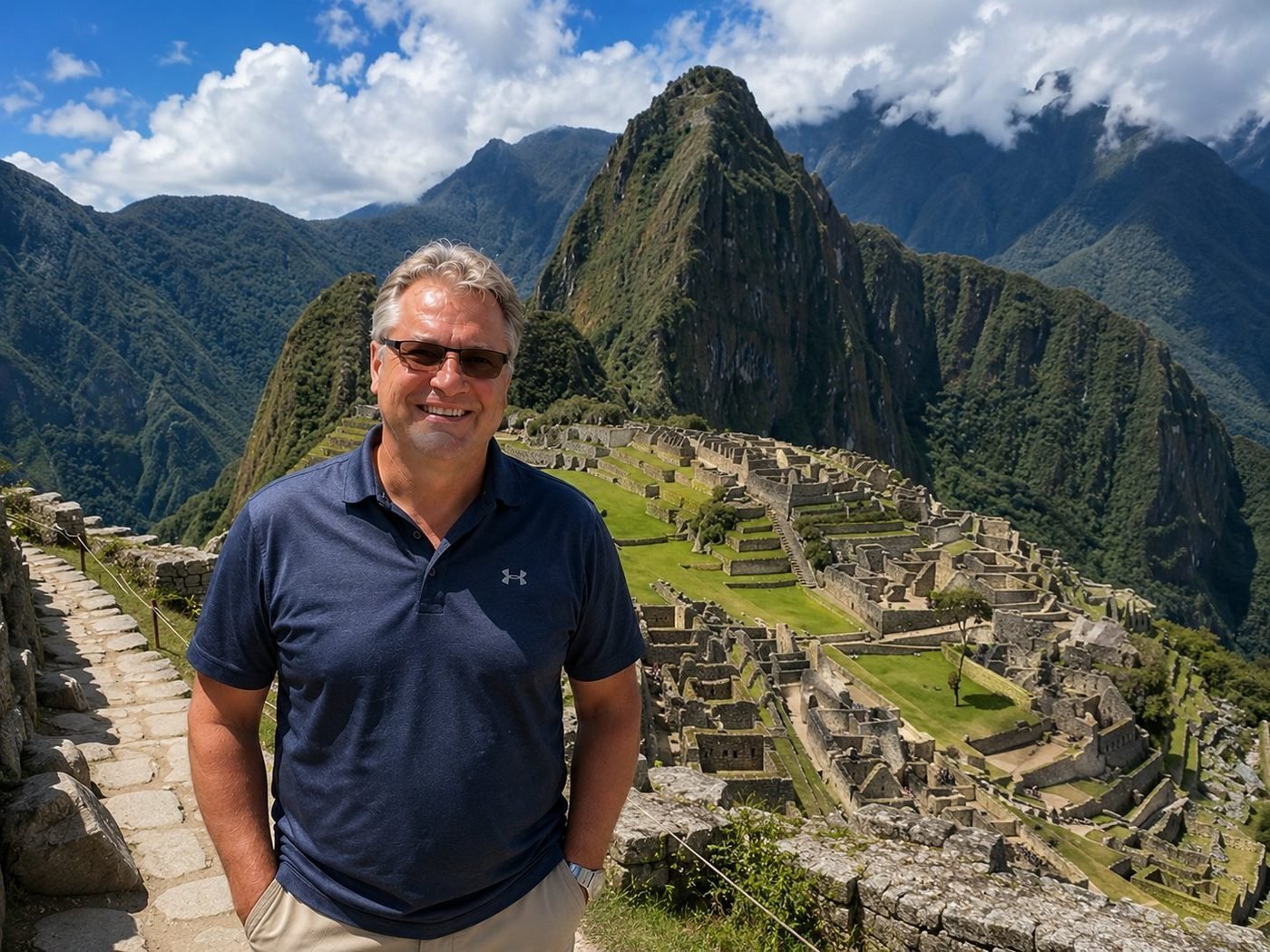
Machu Picchu · the Inca Citadel
The citadel itself is laid out in two halves — agricultural terraces on one side, residential and ceremonial buildings on the other, divided by a central plaza. Whether it was a royal estate, a religious centre, or both, scholars are still arguing. What’s clear is that the people who built it understood drainage, earthquake-resistant masonry, and view planning at a level that any modern architect would recognise as serious work — and they did it five centuries before the term “civil engineer” existed in any language.
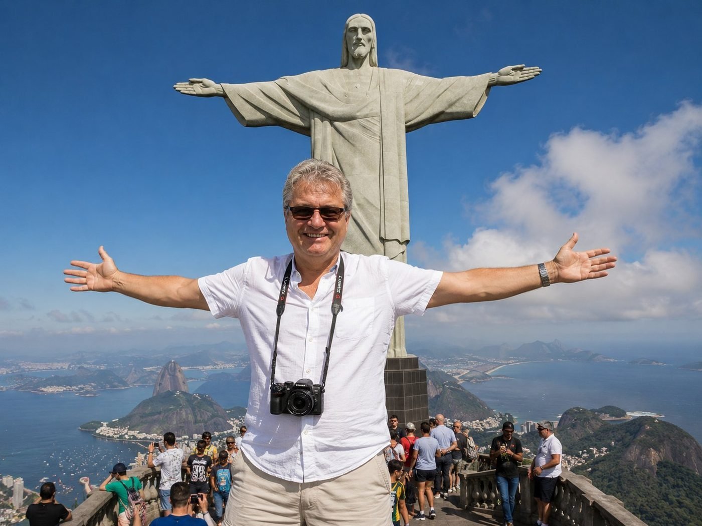
Cristo Redentor · arms outstretched
The statue is 38 metres tall, completed in 1931, art-deco soapstone over a reinforced-concrete frame. It was designed by the Brazilian engineer Heitor da Silva Costa and the French-Polish sculptor Paul Landowski, and sits at 710 metres on Corcovado, looking out over Guanabara Bay. The pose-mimicry photo is a cliché I committed to cheerfully. There’s something about being that high above Rio, with the city and the sea spread below and the wind coming off the Atlantic, that suspends the irony reflex for a few minutes.
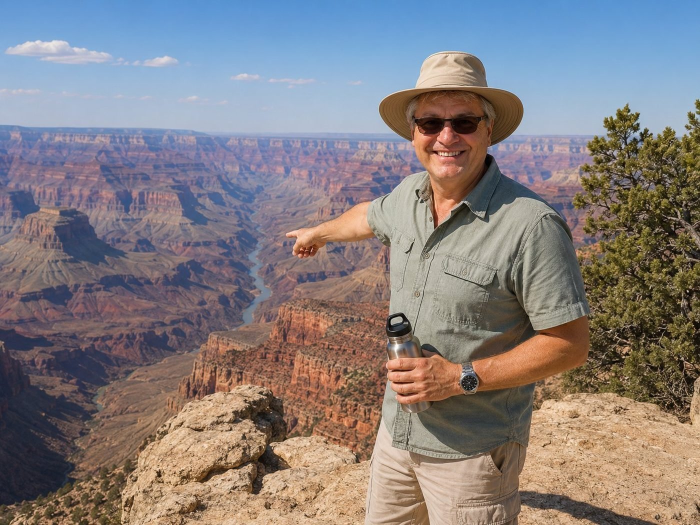
Grand Canyon · the South Rim
The Grand Canyon is one of those landscapes that no photograph quite captures, because what it really has is scale, and scale doesn’t fit in a frame. Six million years of the Colorado River cutting through a kilometre and a half of sedimentary rock, exposing layers from the Cambrian up. The South Rim handles roughly five million visitors a year. The river at the bottom doesn’t notice any of them.
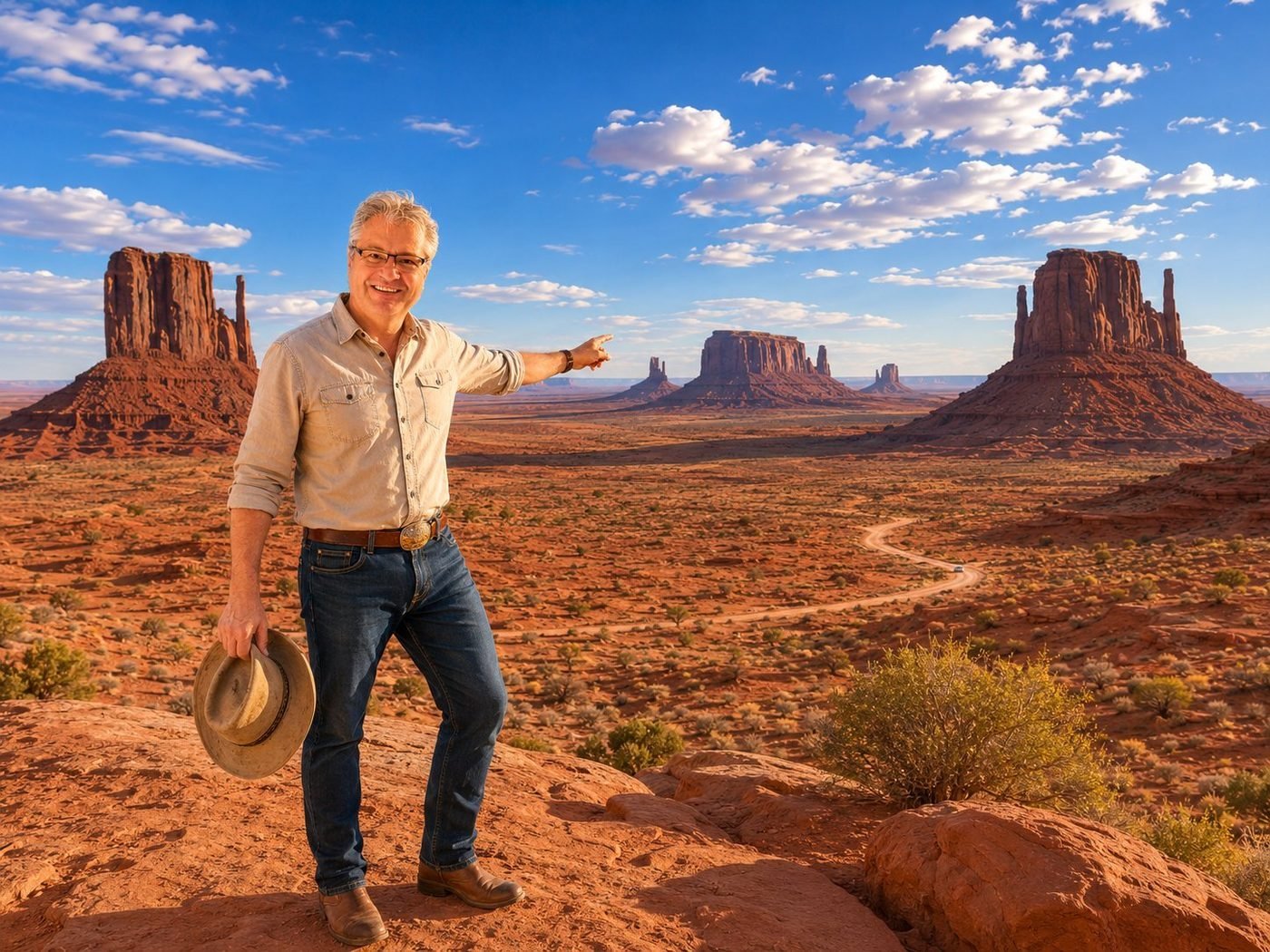
Monument Valley · the Mittens
The two buttes are called the Mittens because they look like a pair of hands, palms inward, thumbs facing the camera. They’re the residual rock of a sandstone layer that eroded around them — the desert is what’s left after time finishes the job. The valley is a Navajo Nation tribal park; everything here, from the road in to the silverwork sold at the visitor centre, runs by Diné. It’s their land. You drive through as a guest, and behave accordingly.
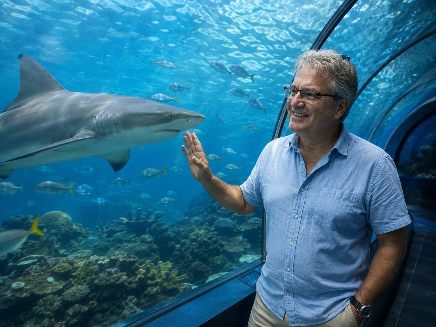
Eye to Eye with a Shark
The acrylic in a tunnel like this is about thirty centimetres thick. Two and a half million litres of saltwater press against it from above; a few thousand fish swim through it; one large reef shark drifts past at eye level. You raise a hand reflexively. The shark, who has done this trip several thousand times before, does not react. He has things to do.
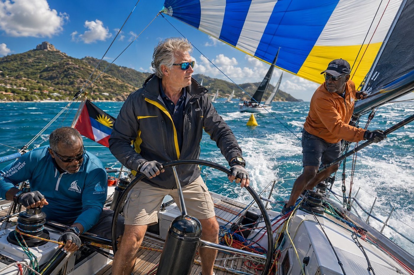
Antigua Sailing Week · at the Helm
Antigua Sailing Week has been held every April since 1968 and is the oldest and largest sailing regatta in the Caribbean. Seventy to a hundred yachts arrive from across the Atlantic and the Americas to race a series of inshore and round-the-island courses over seven days, with the after-races moving each evening to a different historic harbour: Falmouth, English Harbour, Dickenson Bay. The whole thing — the racing, the prize-giving, the rum, the steel pan bands at the dockside — is the Caribbean sailing world’s annual reunion. I sailed the second day on board Endless Pleasure, a 50-foot racing sloop helmed by my friend Augustus and crewed by his old friend Carlton — both of whom learned to sail on these waters as boys in the 1980s. The trade wind held steady at 18 knots; the sea was clean; the spinnaker filled and we surged across the line behind the leaders, the deck heeled so sharply I had to brace my feet against the leeward winch. Augustus told me, as we rounded the windward mark with the spray bursting white over the bow, that the best definition of happiness he knew was a boat that was sailing well, under people who loved her.
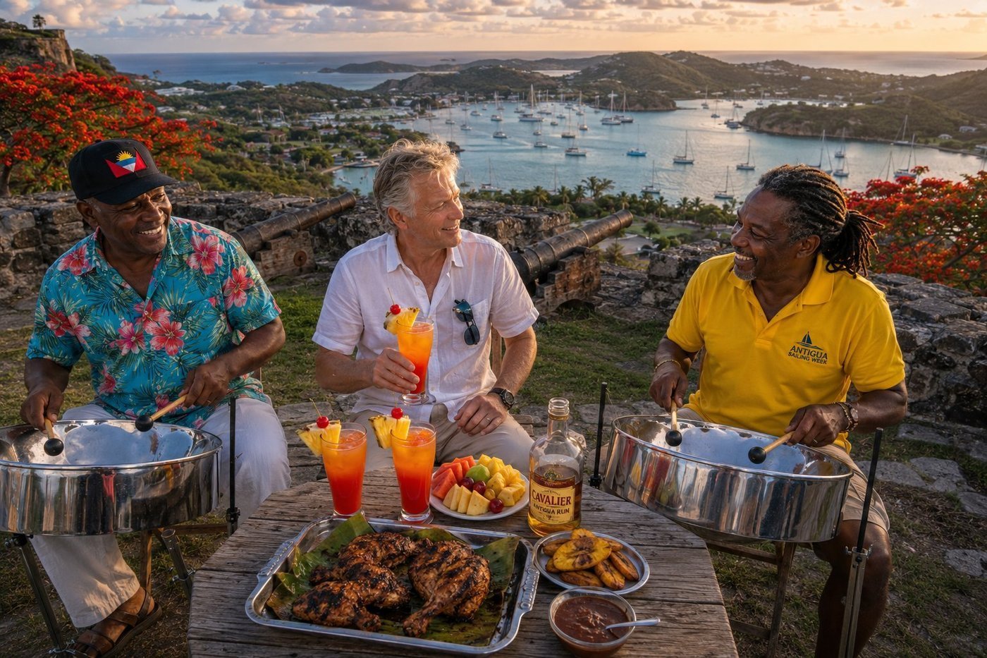
Shirley Heights · the Sunday Sunset
Shirley Heights is the ruined hilltop garrison overlooking English Harbour and Falmouth Harbour from a 200-metre limestone bluff. Built by the British in 1781 to defend the Royal Navy dockyard below, the fortress was abandoned in 1854, and lay forgotten — until, in the late 1980s, someone realized that the view from the ramparts at sunset was perhaps the most photogenic in the eastern Caribbean. The Antiguan government opened it as a viewpoint; an enterprising local started a Sunday afternoon barbecue with rum punch and a steel pan band; and the Shirley Heights Sunday was born. Forty years later it is one of the iconic Caribbean experiences. My friend Owen, the senior steelpan player, has played the Sunday at Shirley Heights for thirty-one years. He told me, mid-set with a wide grin, that the steel pan was Trinidad’s gift to the Caribbean — the only entirely new acoustic instrument invented in the 20th century — and that no Sunday should pass without one. I left at full sunset with the harbour gone gold below and the band moving into "Yellow Bird." Some farewells, the place writes for you.
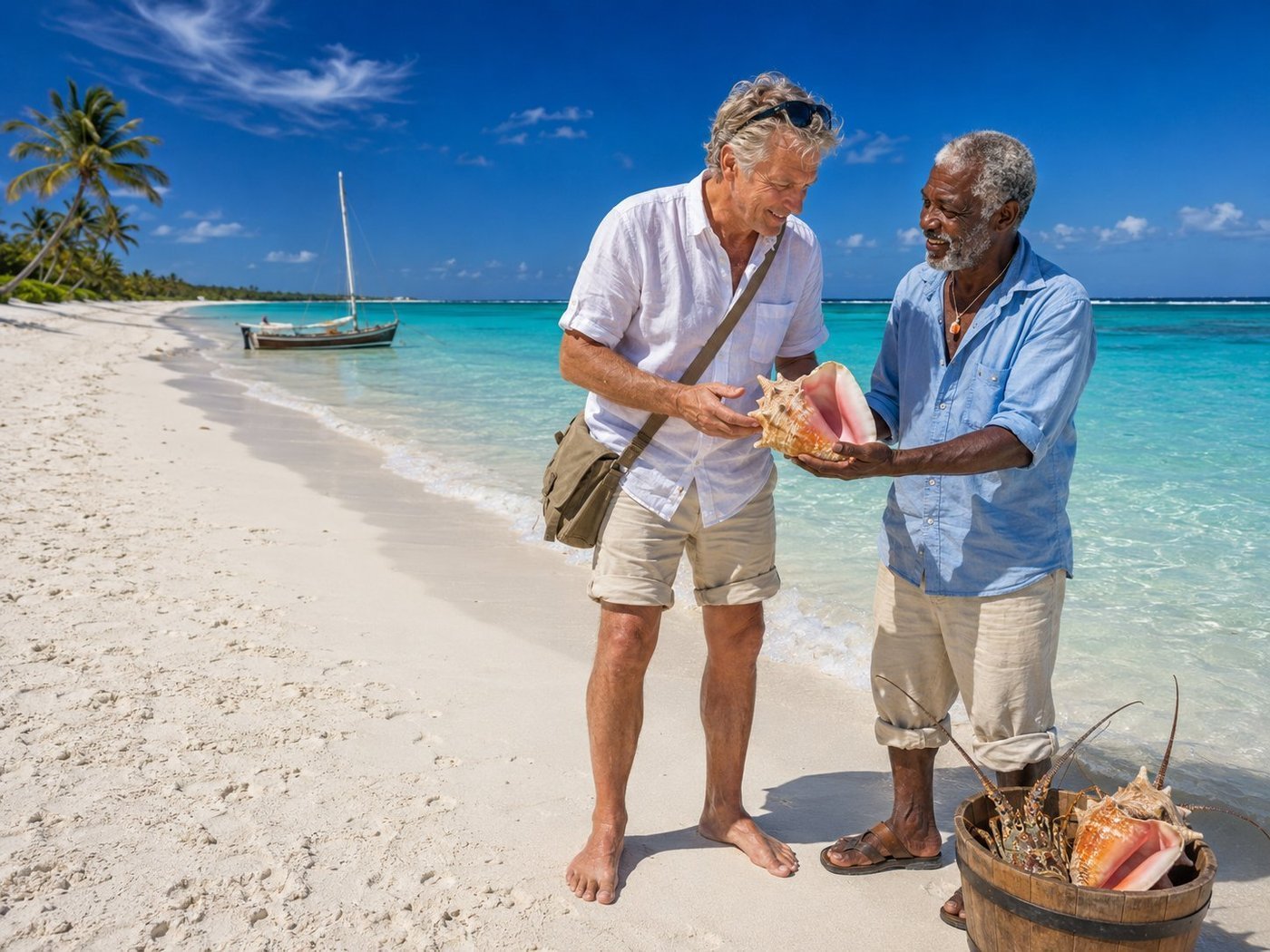
Shoal Bay East · with a Fisherman
Shoal Bay East is two kilometres of bone-white coral sand on the north coast of Anguilla — consistently ranked in the world’s top ten beaches, and remarkable for the fact that you might be one of only twenty people on it on any given weekday morning. The sand is impossibly fine: powdery rather than granular. The water is glass — a calm turquoise lagoon protected by a reef three hundred metres offshore. There are no cruise ships in Anguilla. The whole island has chosen, deliberately, not to have them. My guide that morning was Cleophas, a fourth-generation Anguillian fisherman who works the reefs at dawn for queen conch and Caribbean spiny lobster — the Anguillian crayfish, as the locals call it. He explained how to spot the difference between a mature queen conch and a juvenile (the pink lip flares out only when the conch is fully grown, which takes five to seven years), and that the entire Anguillian fishery is regulated by the village elders rather than by a government bureau. The conch population is healthy. Some traditional systems work better than the modern ones built to replace them.
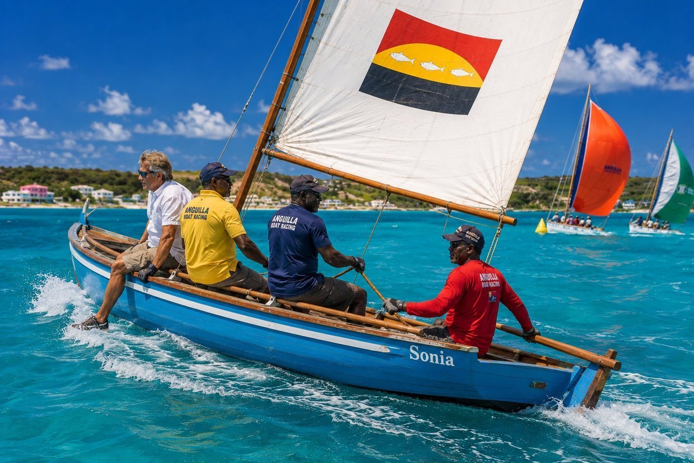
Sonia · the Anguillian Sloop Race
Anguilla is the only country in the world whose national sport is sailing a particular type of small traditional wooden sloop. The Anguillian sloop is a 17-to-28-foot open wooden vessel, hand-built from local white-cedar timber by a small handful of remaining master shipwrights, with a low freeboard, a single gaff-rigged sail, and absolutely no engine or modern accommodation. There are perhaps thirty active racing sloops in Anguilla today; each has a name, a hereditary boat-owning family, and a fanatically loyal local fan base. I crewed on Sonia, a sky-blue 22-footer skippered by Glenford and his crew Lorenzo and Reuben — three friends who have raced together since they were boys. The race that day was a 4-mile course at Sandy Ground Bay; the breeze was a perfect 17 knots; we heeled at a controlled angle with three of us on the windward rail as live ballast and held the lead through the windward mark before losing it on the downwind leg to a 28-footer with more sail area. We finished second of fifteen. Reuben told me, with a wide grin as we pulled into the harbour, that finishing second to a 28-footer in a 22-footer is, on Anguilla, almost the same as winning.
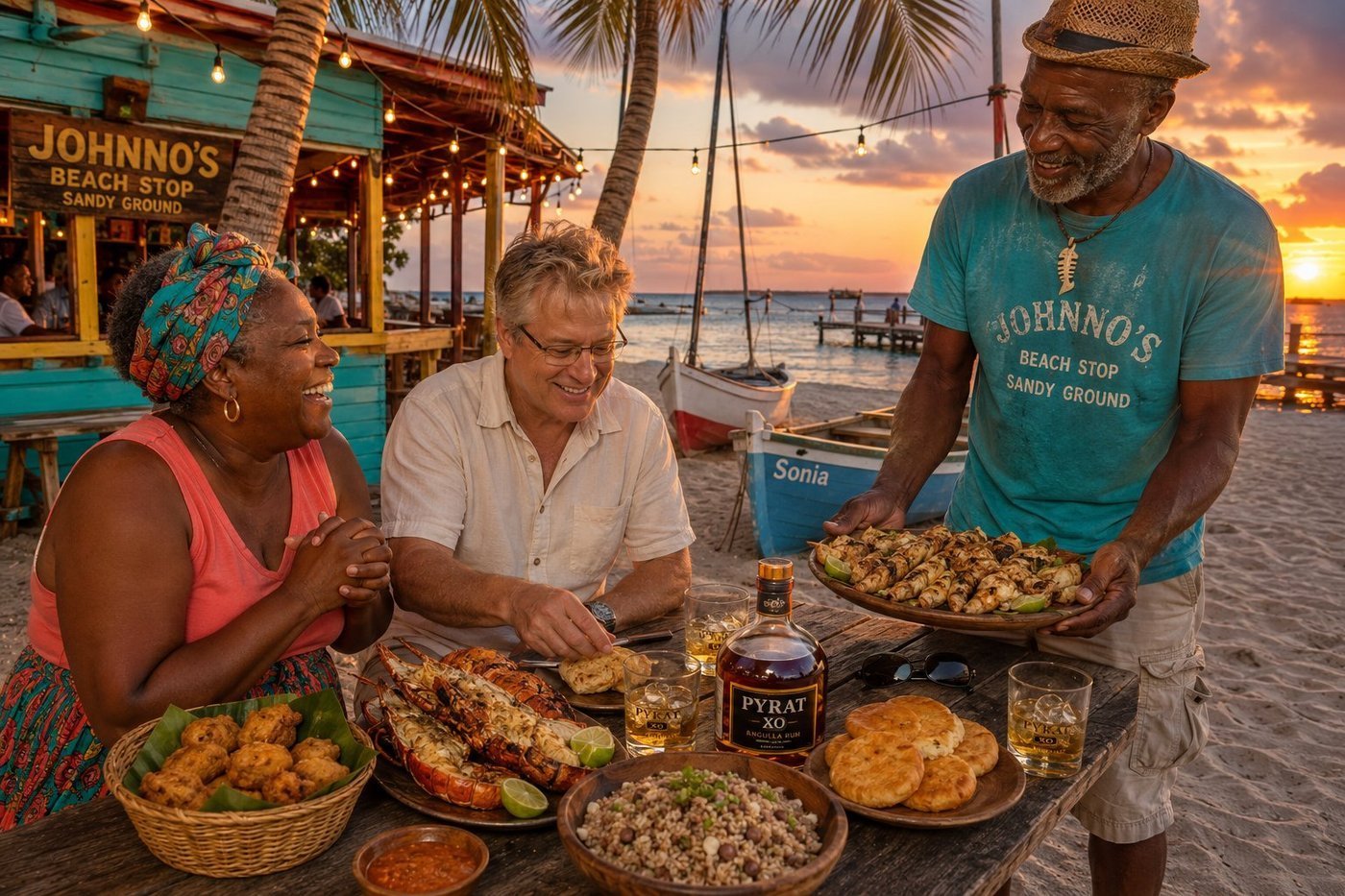
Johnno’s Beach Stop · Conch & Crayfish at Sunset
Johnno’s Beach Stop is a legendary open-air Anguillian beach shack on the sand of Sandy Ground Bay, operating since the late 1970s, founded by an Anguillian fisherman named Johnno and his wife Bonnie. The menu is unchanged in fifty years: whatever was caught off Sandy Ground that morning, grilled over wood embers by Bonnie in the open-air kitchen, served at wooden picnic tables on the sand, accompanied by pigeon peas and rice, johnnycakes, and Pyrat XO rum — the Anguillian rum that has won more international prizes than any other Caribbean spirit. The night I joined them, the haul was excellent: half a dozen queen conch grilled with garlic-lime-butter, a tower of crispy conch fritters from the morning’s catch, and two enormous Caribbean spiny crayfish split lengthwise and grilled on the half-shell. Bonnie’s pigeon peas and rice arrived with a small bowl of her infamous pepper sauce — she warned me, "two drops, no more" — and we ate as the sun went down behind the sloops pulled up on the beach. Johnno told me, as the sky turned orange and the bare bulbs above the table came on, that the conch population on Sandy Ground had been carefully managed by the village for three generations. Anguillan conch is among the best I have ever eaten. The setting helps.
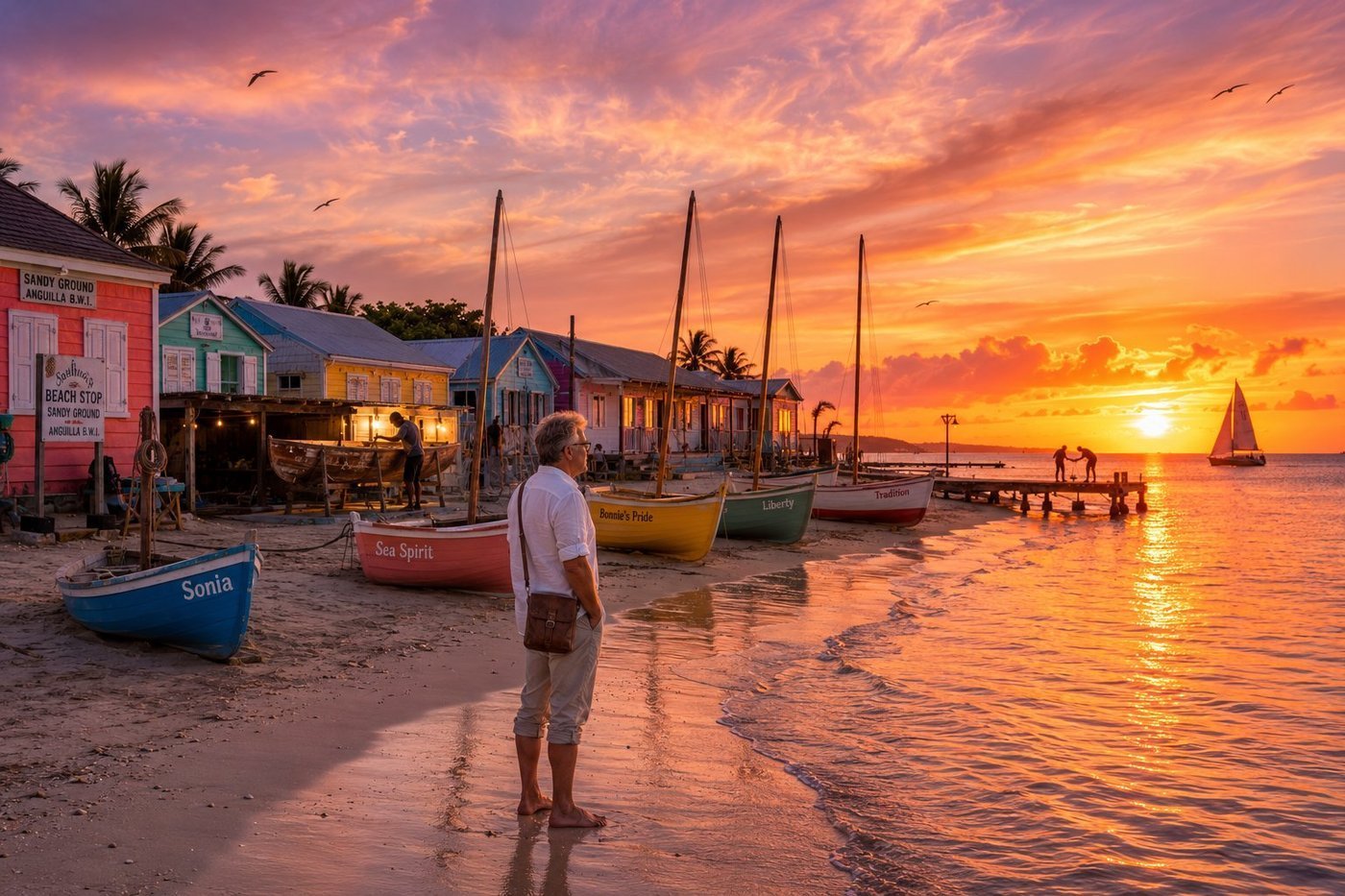
Sandy Ground · Sunset Among the Sloops
Sandy Ground is a single curved bay on the leeward coast of Anguilla, perhaps a kilometre of pale coral sand pressed between the Salt Pond inland and the Caribbean Sea — and it is, in a quiet way, the cultural centre of the island. The racing sloops live here, drawn up on the sand between regattas with their masts unstepped, each named (Sonia, Sea Spirit, Bonnie’s Pride, Liberty, Tradition) and each tended by a hereditary boat-owning family. The shipwrights work on them in plain sight, in open lean-to sheds among the pastel houses, planking and caulking with cedar and oakum exactly as their grandfathers did. On the dock, fishermen mend gear at the end of the day. Walking the beach at sunset alone, with the sky turning the colour of a ripe mango and the wet sand mirroring it back, I had the strange and clarifying thought that I was looking at a complete and self-sufficient civilisation — a fishing village, a boatyard, a national sport, and a sense of identity — fitted onto a single beach. The frigatebirds wheeled overhead, the lights came on in the houses behind me, and somewhere down the strand a single sailboat slipped past the headland and on toward Saint Martin.
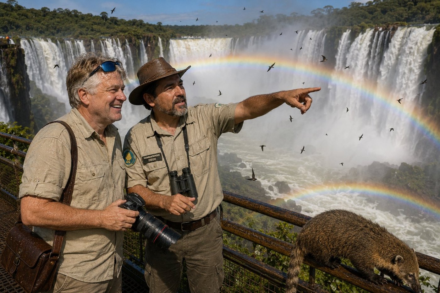
Garganta del Diablo · The Devil’s Throat
The Iguazu Falls — Cataratas del Iguazú in Spanish, Cataratas do Iguaçu in Portuguese — are not one waterfall but 275, ranged along a 2.7-kilometre horseshoe in the dense subtropical rainforest where Argentina meets Brazil. The chasm at the heart of the system, the Garganta del Diablo, is a U-shaped vertical drop of 82 metres into which roughly half of the river’s volume thunders — a column of water so powerful and so loud that the spray rises hundreds of metres into the rainforest canopy and the noise can be heard from kilometres away. The walkway at its edge, suspended over the abyss on a metal grating, is one of the most physical experiences in world travel: the railing trembles underfoot, the spray drenches you completely, and rainbows materialize and dissolve in seconds in the curtain of mist. Diego, the Argentine guardaparque who walked me out that morning, pointed up to a flock of great dusky swifts — small dark birds that nest behind the curtain of falling water itself, on cliff ledges no predator can ever reach. The swifts fly in and out through the cataracts. Diego asked me, with the patient amusement of someone who has watched ten thousand tourists arrive at this exact moment of bafflement, whether I had ever seen anything more impossible. I had not. I still have not.
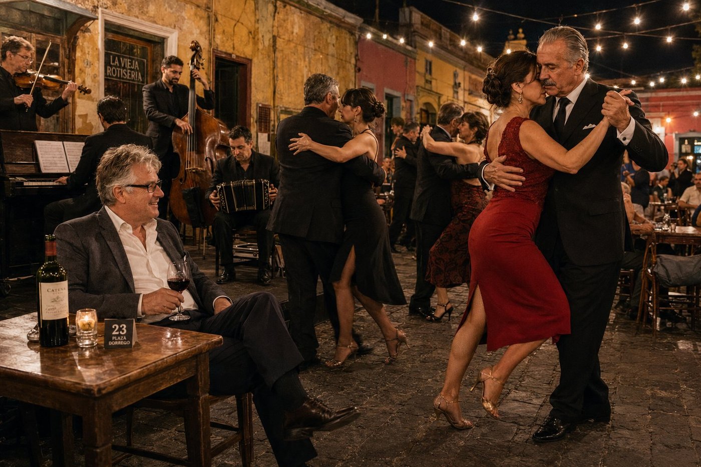
A San Telmo Milonga · Plaza Dorrego
A milonga is not a dance lesson and it is not a show. It is the social gathering where tango actually happens: porteños who have been dancing together for thirty or forty years meeting on a Sunday evening at the edge of an old plaza, in the open air, to dance for a couple of hours in a strictly codified order — three tangos, then three valses, then three milongas, then a cortina to clear the floor and start again. The most beautiful milonga in Buenos Aires, by general agreement, is the Sunday-evening one at Plaza Dorrego in San Telmo, the city’s oldest neighborhood. Couples take the cobblestones; an orquesta típica — piano, violin, double bass, and bandoneón — plays under a string of Edison bulbs strung between the balconies of pink-and-yellow colonial buildings; the surrounding cafés serve Malbec to the watching ring of locals, expatriates, and a few respectful tourists. I sat at table 23 with a bottle of Catena and watched, over the course of a single tanda, the precise moment at which the lead’s improvisation passed cleanly into the follow’s response — the moment, as a retired milonguero at the next table put it to me, when the conversation happens. Argentine tango is not danced. It is spoken, with the feet, in two voices, in a language only the two of them know.
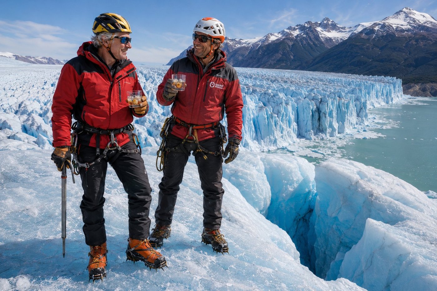
Perito Moreno · Whisky on Six-Hundred-Year-Old Ice
The Perito Moreno is one of the only large glaciers in the world that is not retreating. While ninety percent of Earth’s glaciers are losing mass, this one — fed by the immense Southern Patagonian Ice Field, the third-largest reserve of fresh water on Earth after Antarctica and Greenland — continues to advance at roughly two metres a day. Its 5-kilometre-wide, 70-metre-high front terminates in the brackish waters of Lago Argentino, and every two to four years a spectacular natural event occurs: the glacier advances far enough to dam an arm of the lake, the water level behind the dam rises by several metres over months, the ice eventually fractures from the pressure, and the entire ice arch collapses into the lake in front of thousands of spectators on the opposite shore. Matías, my mountain guide from Hielo y Aventura — the only company licensed to take small groups onto the actual surface of the glacier — has been walking this ice for eighteen years. At the end of the four-hour trek, on a flat shelf above a brilliant cobalt-blue crevasse, he chipped two cubes of glacial ice straight off the wall with the head of his ice axe, dropped them into two tumblers, and poured a precise measure of an Argentine single-malt over each. The ice, compressed for six hundred years, melts very slowly. The whisky, he observed, was excellent. So was the ice. The two had been waiting six centuries to meet.
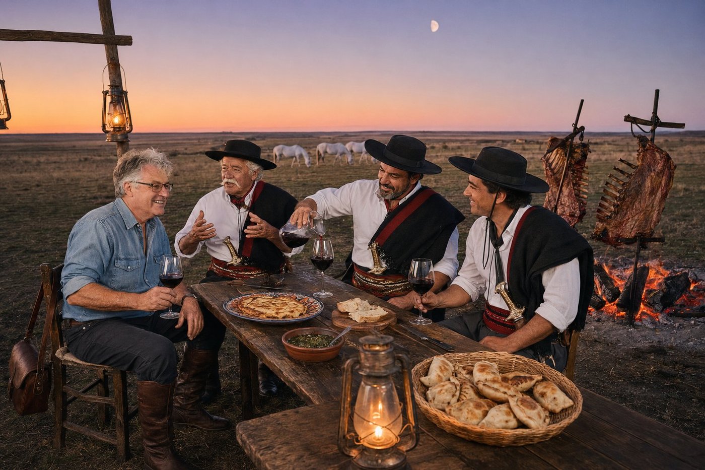
Asado in the Pampa
The asado is not a meal. It is a four-hour social ritual that happens to involve enormous quantities of beef. The fire is lit two hours before anyone eats; the wood — ideally quebracho, the densest hardwood of the South American plains — burns down to a deep bed of glowing embers before the meat goes anywhere near it. The cuts go on in a strict order: chorizo and morcilla sausages first, then provoleta cheese on the parrilla, then ribs and tira de asado on crossed iron crucifixes tilted toward the embers, then the larger cuts of vacío and matambre. Chimichurri is mixed an hour ahead and never refrigerated. Malbec is poured generously and almost continuously. The conversation is the point. The meat is the occasion. I was lucky enough to be invited to an asado in the pampa proper — roughly two hundred kilometres south of Buenos Aires, on a small ranch belonging to Don Eduardo, a third-generation gaucho who told me, between cuts of perfectly rendered beef rib, that the proper length of an asado is “the length of the longest story anybody at the table still has to tell.” Hernán, his neighbor, and Joaquín, his godson, were both there, both in the full gaucho rig of poncho, faja sash, facón knife, and tall riding boots, both telling stories about their fathers and grandfathers and the horses they had ridden together across these plains for the better part of a century. I have been to dinners in forty-seven countries. None of them was anything like this one.
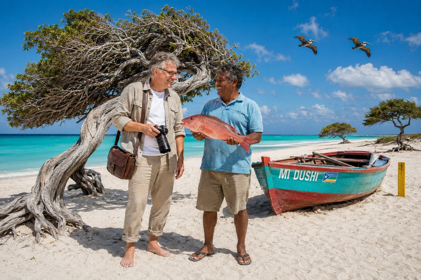
Eagle Beach & the Fofoti Tree
Aruba is the desert Caribbean. Twenty-nine kilometres long, sitting just nineteen kilometres off the Venezuelan coast and entirely outside the Atlantic hurricane belt, the island gets less than half a metre of rain a year — enough to support divi-divi trees, fofoti trees, organ-pipe cactus, and very little else. What it has in abundance is white sand, blue water, year-round trade winds from the east at fifteen knots, and the kind of consistent sunshine that has made it the most-returned-to destination in the Caribbean for North American visitors. The fofoti tree behind us — Conocarpus erectus — is Aruba’s national symbol. The constant wind has bent every fofoti and every divi-divi on the island into the same westward lean. They look intentional. They are not. They are simply trees that have spent every day of their lives being pushed in the same direction by the same wind. Eddy, my host that morning, is a third-generation fisherman from Savaneta on the south coast. He runs his small wooden boat Mi Dushi — Papiamento for "my sweetheart" — out before dawn and back by ten, working the reef for red snapper, mahi-mahi, and the small Caribbean spiny lobster that the Aruban kitchen turns into the island’s best dishes. He told me, with the kind of smile and shrug that I have only ever seen on people who live close to the ocean, that the secret of a good day in Aruba is to be on the water before the wind picks up, and on the sand before the sun is too high.
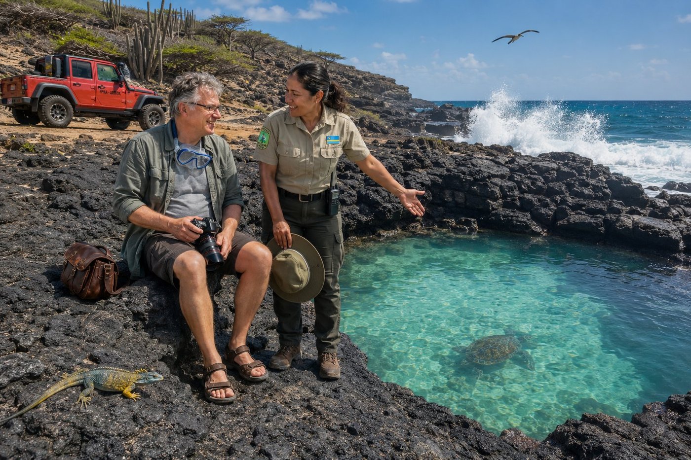
Conchi Natural Pool — Arikok National Park
Conchi — also called Cura di Tortuga, “the turtle’s pen” — is a near-perfect circular pool of crystal-clear turquoise water cut into the wild Atlantic coast of Aruba, sheltered by a natural ring of volcanic rock that has been sculpted into ribbed, almost lunar formations by ten million years of waves. On the outside of the ring, the open Atlantic crashes against the rocks in three-metre spray. On the inside, the water is glass. Reaching the pool requires either a 4x4 across an hour of rough unpaved track through the cactus interior of Arikok National Park, a horse, or a four-mile hike under a sun that does not negotiate. The park covers roughly 18 percent of the island — a deliberate, hard-fought conservation choice in a country whose economy runs on resort tourism — and protects the last remaining wilderness of the Caribbean’s desert outpost: organ-pipe cactus, divi-divi trees, the endemic Aruban whiptail lizard, ancient Caquetío Amerindian rock paintings, and a small handful of green sea turtles that drift in through gaps in the rocks at high tide and rest in the pool until the next current turns. Glenda, the ranger who took me out that morning in her department Jeep, told me there are days when she counts twelve turtles inside Conchi. The day we went there was one. I went into the water with the snorkel and stayed an hour. She politely declined to join me. Park rangers, she said, work for the turtles, not with them.
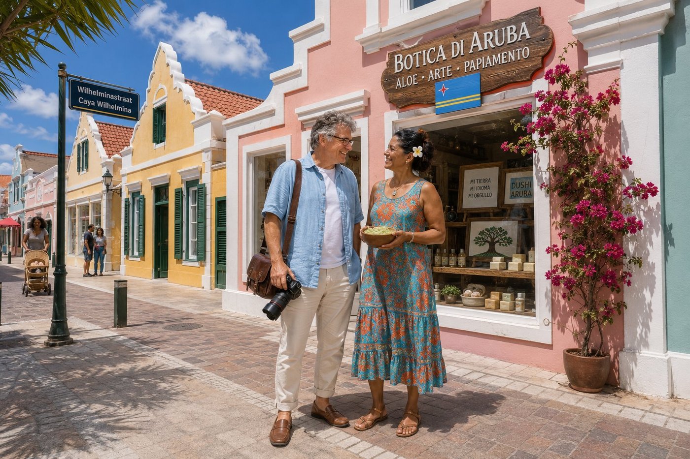
Wilhelminastraat & Botica di Aruba
Oranjestad — “Orange Town,” named after Holland’s House of Orange-Nassau in 1824 — is one of the most cheerfully painted small capitals on Earth. A few blocks of Dutch colonial merchant houses with crow-stepped gables along Wilhelminastraat and Caya G.F. Betico Croes, each one painted in a different sherbet pastel (salmon, mustard, aquamarine, mint, lilac), the whole row maintained with the kind of municipal fastidiousness that the Dutch still export to their constituent countries. Aruba has spoken four languages in daily rotation for two centuries: Papiamento (the Creole that arose from Portuguese, Spanish, Dutch, and West African Bantu and is now the island’s most-used language), Dutch (the constitutional language of the Kingdom), Spanish (Venezuela is nineteen kilometres away), and English (the tourists are everywhere). Children are schooled in all four. Street signs are bilingual. Most shopkeepers will greet you in three of the four before settling on whichever one you answered in. Marisela runs a small Botica di Aruba on Wilhelminastraat selling artisanal aloe products — Aruba’s historical export crop, cultivated on the island since the Dutch West India Company planted the first commercial fields here in 1840, and still the source of one of the most medicinally potent strains of Aloe vera barbadensis miller in the world. The aloe in the bowl she handed me was harvested by her brother that morning in Hato. Apply it, she said, on any sun you have not yet got but plan to.
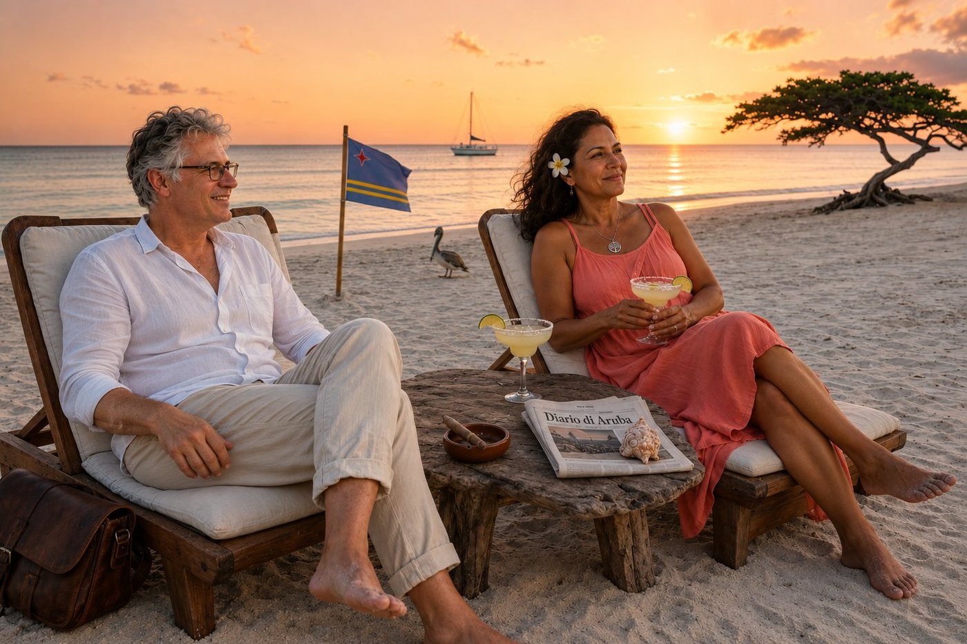
Sunset & Margaritas on Eagle Beach
Aruba is famous for its sunsets. It sits twelve degrees north of the equator in the southern Caribbean, just outside the hurricane belt, with year-round low humidity — less than half a metre of rain a year — constant easterly trade winds that scrub the atmosphere clean, and a sun that drops out of a perfectly clear sky into the Caribbean Sea every day of the year. The combination produces sunsets of such consistency and intensity that they have become a tourism category of their own. Local restaurants advertise “sunset menus.” Hotels charge premium for sunset-facing rooms. The island’s tourism board markets “Aruban Sunset Cruises” as a primary attraction. Even the locals — who have watched this happen approximately every evening of their lives — still pause mid-conversation when the sky turns coral. Sofia, who has lived on Aruba for fifty-three years, says the proper way to receive an Aruban sunset is not photographically. You sit. You stop talking. You let the colour happen to you. A margarita, a Cohiba, the surf, the slow march of pink-into-violet across the sky, and the kind of quiet that the modern world has nearly forgotten how to produce. We watched it together with very little to say. Some days, the trip gives you what you came for.
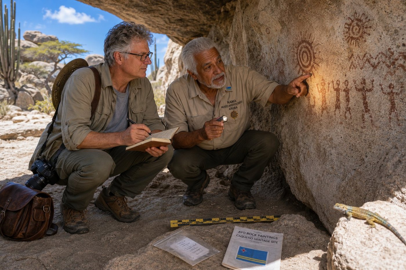
Caquetío Pictographs at Ayo Rock
Long before any European map carried the word “Aruba” — about a millennium before, in fact — the people who lived here were Caquetío. They arrived from the Venezuelan mainland around AD 1000 as part of the great Arawak migrations that populated the entire Caribbean, displacing the earlier pre-ceramic peoples. They were fishermen, farmers of cassava and maize, skilled potters; their language, related to other Arawakan tongues, was the source of words that survive in modern Aruban Papiamento — including, the linguists say, the word ARUBA itself, which probably derives from Caquetío oibubai, meaning roughly “guide” or “companion.” They lived undisturbed on this island for five hundred years. Then, in 1499, the Spanish navigator Alonso de Ojeda sailed past with Amerigo Vespucci on board, claimed the island for the Crown of Castile, and within a generation most of the Caquetío had been deported to Hispaniola as slave labour. The few who remained were absorbed, over the next four centuries of colonial rule, into what became the modern Aruban population — where their DNA still lives in roughly half of all native Arubans, and their bloodline shows quietly in the dark eyes and high cheekbones of the people you meet in the cunucu countryside. What they left behind, etched in red ochre and dark iron oxide onto the pale granitic boulders of Ayo and Casibari and the deep cool walls of Fontein Cave, are about four hundred pictographs: sun-disks, stick figures, concentric circles, zigzags. Dr. Augusto Croes of the National Archaeological Museum took me into the chamber at Ayo with a flashlight and a thirty-centimetre ruler. I asked him whether the modern Aruban government did enough to protect these sites. He looked at the pictographs for a moment, then at me, and said quietly: “We do what we can. They are old. They were here long before us. They will, with luck, be here long after.”
🌏 Asia & Middle East12 photos · 7 countries
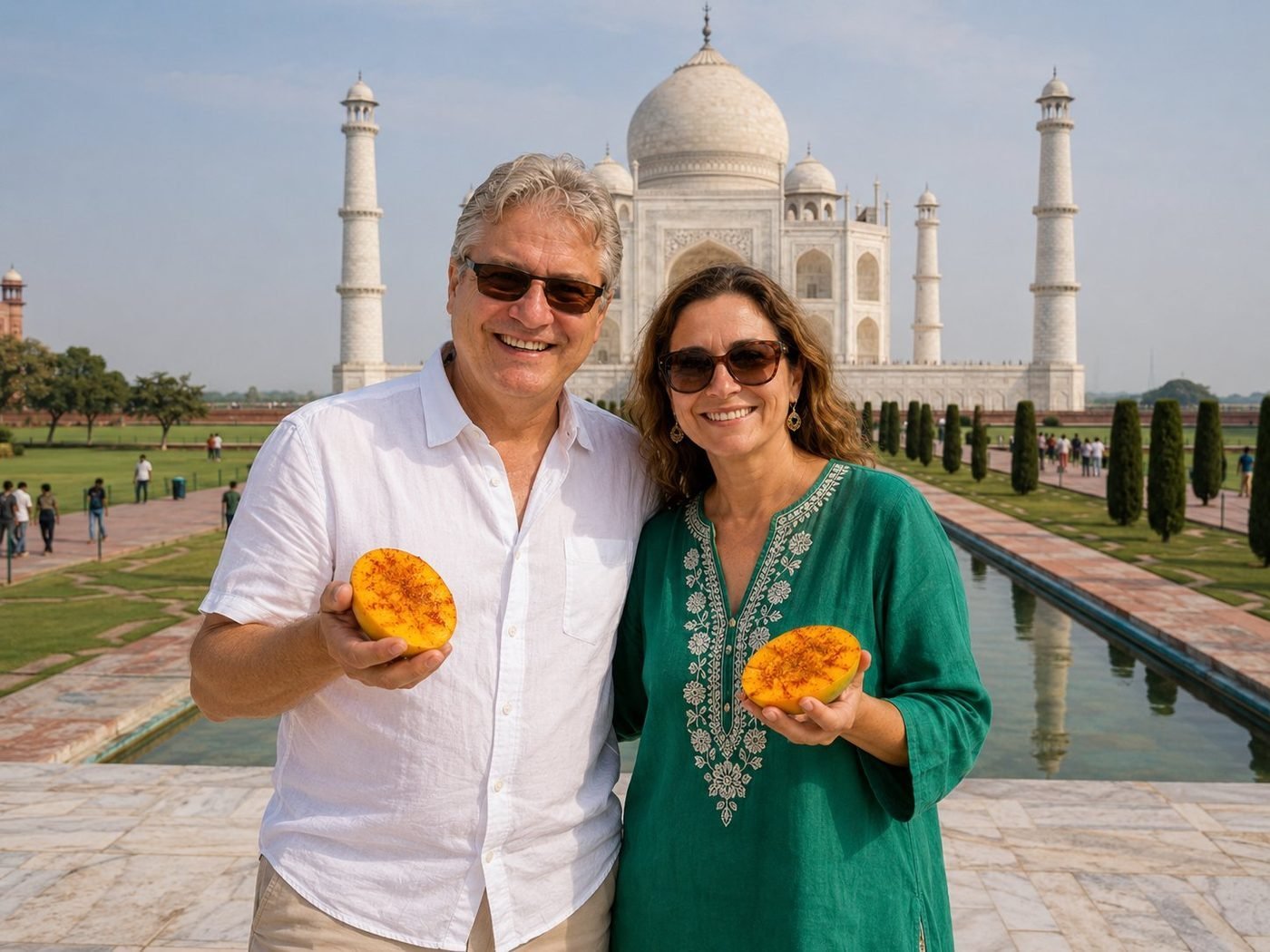
The Taj Mahal · with mango and a friend
A friend from Delhi met us in Agra and brought the mangoes — Alphonsos in season, halved, dusted with chaat masala. There’s a strict scoring system for Indian mangoes; she explained the politics of it (Alphonso from Maharashtra versus Kesar from Gujarat versus Dasheri from UP) with the seriousness Europeans reserve for first-growth Bordeaux. The Taj behind us was beautiful. The mango, that afternoon, was the conversation.
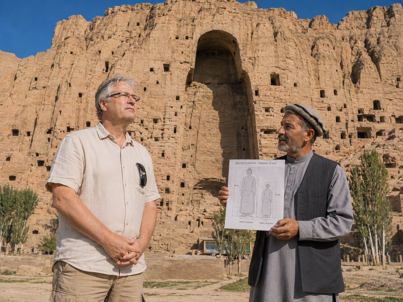
Bamyan · the Shape of an Absence
Two colossal Buddhas — 55 and 38 metres — were carved into these cliffs in the 6th century, the largest standing Buddhas in the world for almost fifteen hundred years. The Silk Road passed through this valley; Chinese pilgrims came to see them; the monk Xuanzang described them in the 7th century. In March 2001 the Taliban destroyed both with explosives over twenty-five days. What remains is the niche itself — a vast trapezoidal void cut into the cliff, still bearing the outline of where the robes were carved. Standing in front of it with my guide Hassan, I understood, finally, what the word absence can mean. A photograph cannot capture it. A statue could not either. The niche, it turns out, is the most eloquent thing of all.
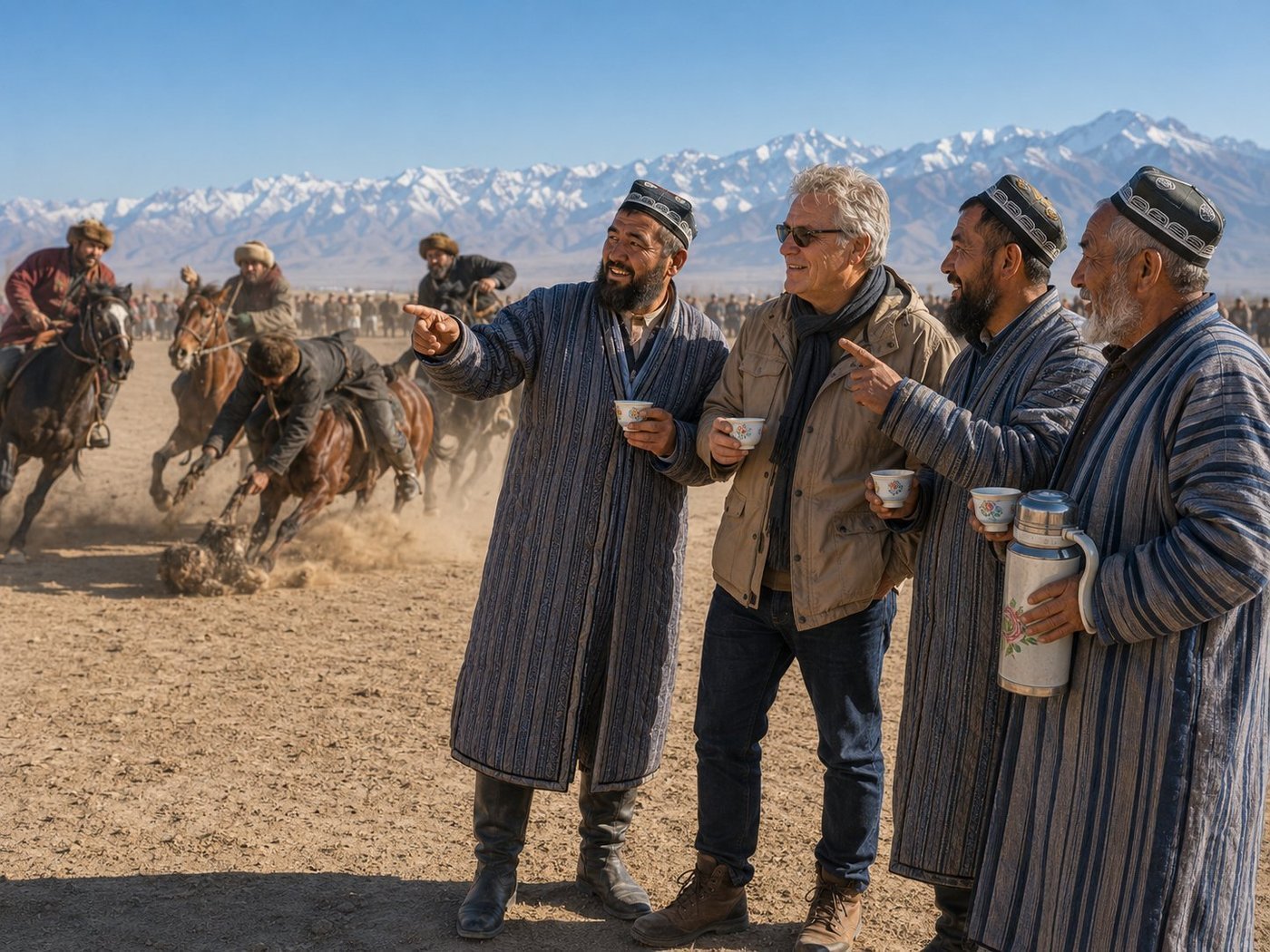
Buzkashi · with Three Uzbek Friends
Buzkashi — literally "goat-grabbing" — is to Central Asia what cricket is to South Asia or jousting was to medieval Europe: the sport that defines a people. Two teams of riders compete to grab a headless goat or calf carcass and carry it to a chalk circle. The matches are chaotic, fast, brutally physical. The riders, the chapandazan, train for years; the horses are bred for the sport; the best matches happen on Fridays during the cool half of the year on the plains north of Mazar. I watched my first match in the company of three Uzbek-Afghan friends, locals from the village whose hospitality was so excessive as to be embarrassing. They handed me a cup of green tea from a battered thermos before I could ask, explained which rider belonged to which team, and laughed at the right moments. The match lasted ninety minutes; the dust never settled; by the end I could not have told you which side won, only that I had been welcomed into something larger than myself.
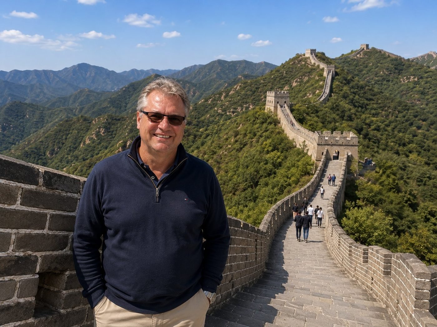
The Great Wall
What’s called “The Great Wall” is really a network of walls, built and rebuilt over twenty-three centuries — Qin, Han, Sui, Jin, and most prominently Ming. Total length, depending on how you count, is somewhere between 8,000 and 21,000 kilometres. The section at Mutianyu, north of Beijing, was restored by the Ming in the 1400s and again by the PRC in the 1980s. You can walk for hours on it. It’s still a serious hike.
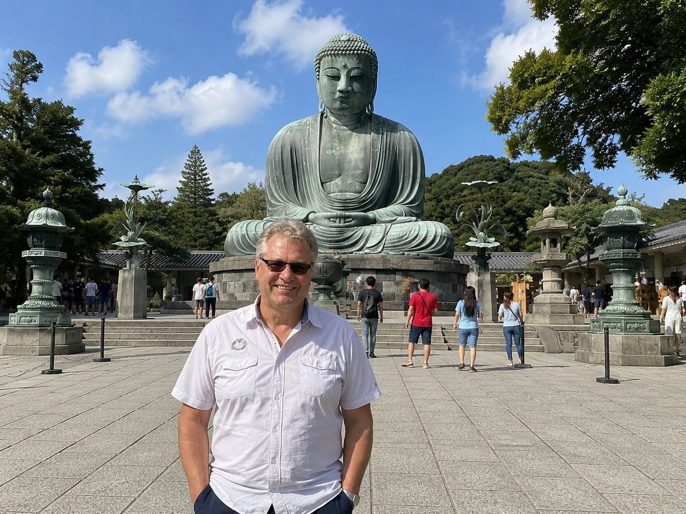
The Great Buddha · Kōtoku-in Temple
The Daibutsu is 13.35 metres of bronze cast in 1252, originally housed in a wooden temple hall that was destroyed by a tsunami in 1498 — and the Buddha has been sitting outdoors ever since. He represents Amida, the Buddha of the Pure Land. The lotus-shaped bronze lanterns to either side were added much later. Standing in front of him I thought, briefly, about how few things last 770 years. He didn’t seem worried about it.
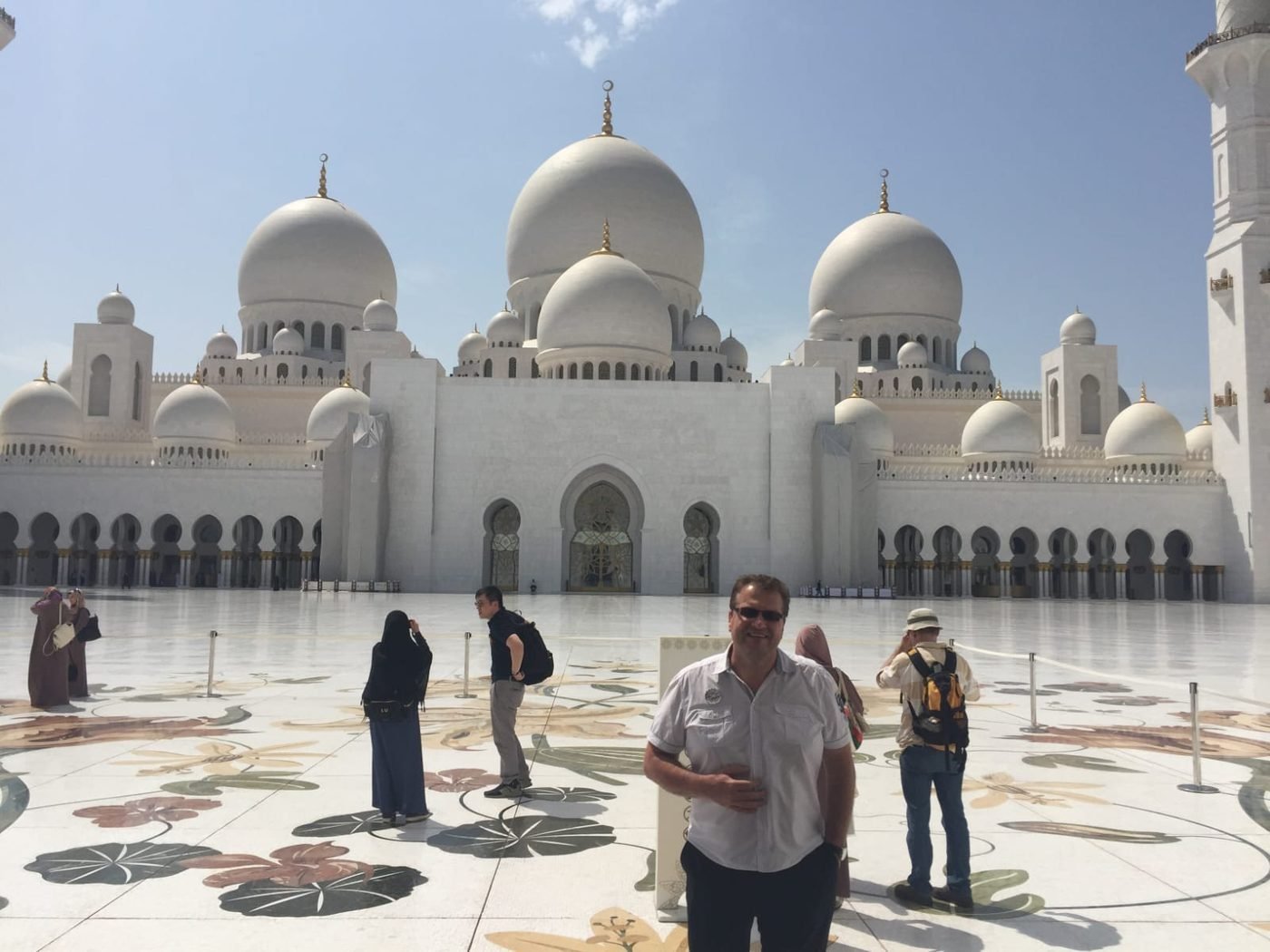
Sheikh Zayed Grand Mosque · Courtyard
The mosque was commissioned in the 1990s by the founding president of the UAE, Sheikh Zayed bin Sultan Al Nahyan, who is buried in its grounds. It opened in 2007. The main courtyard is 17,000 square metres of inlaid white marble laid with floral patterns in semi-precious stones — lapis, mother-of-pearl, jasper, red agate. The whole compound holds 40,000 worshippers. Architecturally it’s a synthesis of Mughal, Moorish, and Egyptian Mamluk traditions, executed at a scale where craft tips into spectacle.
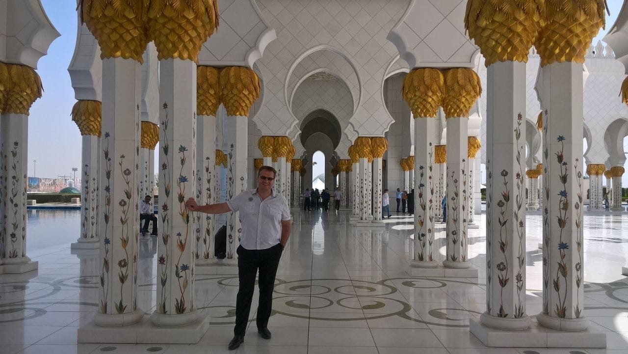
Sheikh Zayed Grand Mosque · Colonnade
The colonnades that frame the courtyard contain 1,096 columns inlaid with floral marquetry, each capped by a gilded date-palm capital. The inlay pattern runs continuous across the whole arcade — you can walk a kilometre under these arches and never see the same flower twice. Thirty-eight contracting companies and three thousand workers built it. I found the maths of the project almost more impressive than its visual effect; the visual effect, meanwhile, was doing fine on its own.
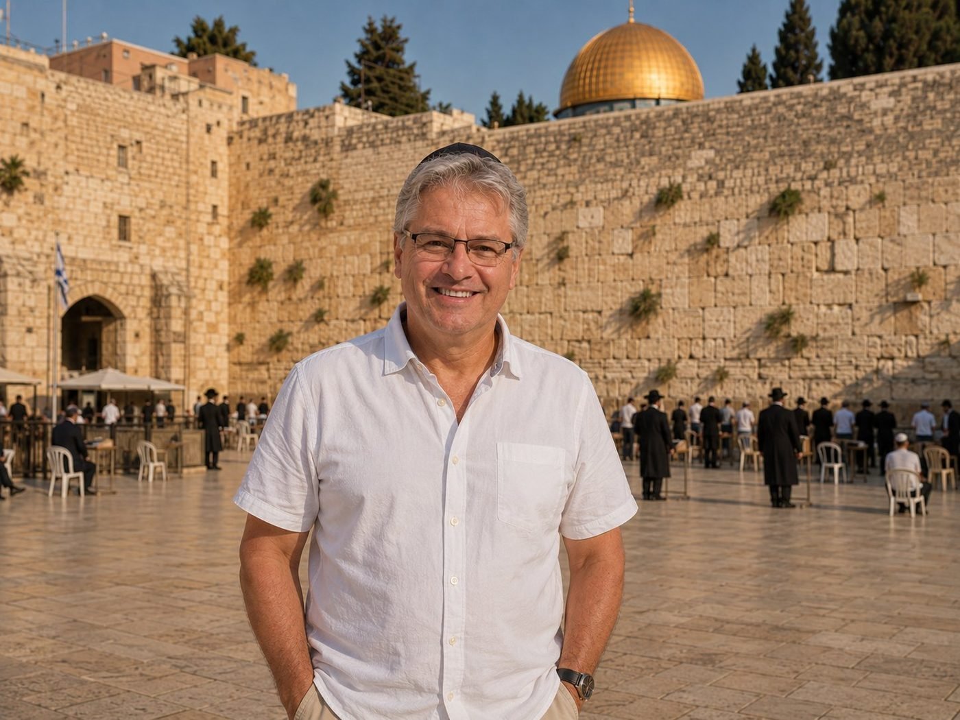
The Western Wall & Dome of the Rock
The Western Wall is the surviving retaining wall of the platform Herod the Great built around 19 BCE to expand the Second Temple. The Dome of the Rock, gold-leafed, was completed by the Umayyad caliph Abd al-Malik in 691 CE — the third-holiest site in Islam — built directly on top of the platform Herod made. Three traditions, all claiming the same hill. Standing in the plaza with a kippah on, you can feel the layered weight of it without committing to any one reading. Few places on Earth ask more from their visitors than this one. None ask quite the same things.
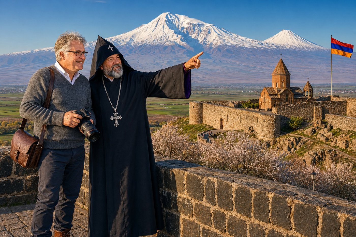
Khor Virap & Mount Ararat
Khor Virap — Armenian for “the Deep Dungeon” — is the monastery built on the spot where, in the year 287 AD, the Armenian king Tiridates III imprisoned Saint Gregory the Illuminator in an underground pit, 6 metres deep, for thirteen years. Gregory survived. When he was finally brought back to the surface, he converted Tiridates and the entire Armenian nation to Christianity in 301 AD — making Armenia the first country on Earth to adopt Christianity as a state religion, a full twelve years before Constantine even legalized it in Rome. The monastery on the spot, in its current 17th-century form, sits on a basalt hill on the floor of the Ararat Plain about 8 kilometres from the closed border with Turkey. And directly behind it, framed exactly as if by deliberate composition of the landscape itself, rises Mount Ararat — the 5,137-metre twin-peaked volcano that is the spiritual mountain of the Armenian people and the mountain on which Noah’s Ark, according to the Book of Genesis, came to rest after the Flood. Father Tigran, who walked the monastery walls with me at dawn, told me, very quietly, that the strangest thing about being an Armenian is that the most important mountain of your civilization is something you can see every day but cannot cross to. You learn to make peace with that. Or you don’t.
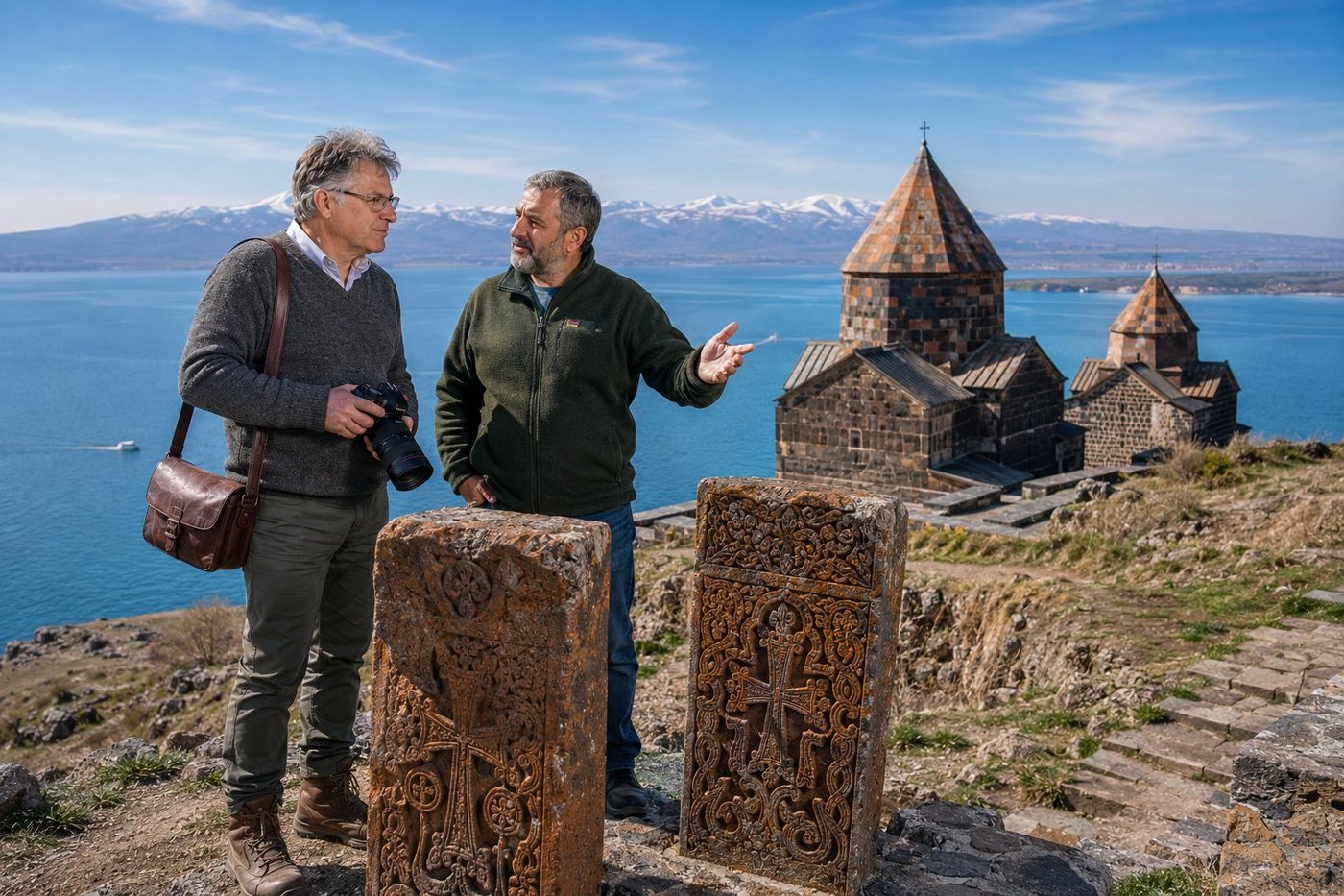
Sevanavank & Lake Sevan
Sevanavank — the “Monastery of Sevan” — perches 1,900 metres above sea level on what was once an island in the largest lake of the Caucasus. The two surviving churches were founded in 874 AD by Princess Mariam, daughter of King Ashot I Bagratuni, as penance for an Armenian victory over Arab forces; for the better part of a thousand years monks lived here in deliberate isolation, reachable only by boat. Then in the 1930s Soviet engineers drained twenty metres off Lake Sevan to feed irrigation canals on the Ararat Plain, and the island slowly became a peninsula. What the receding waters revealed was always there: khachkars — “cross-stones” — carved with interlaced crosses and pomegranate vines, watching over a lake so blue it seems borrowed from a deeper sky. Vahan, a son of the Sevan shore who guided me up the steps that morning, told me the trout here is called ishkhan, which in Armenian means “the prince,” and that in the old times it was carried fresh on horseback all the way to the courts of Persia. We stood for a long time without saying anything. The lake does that to people.
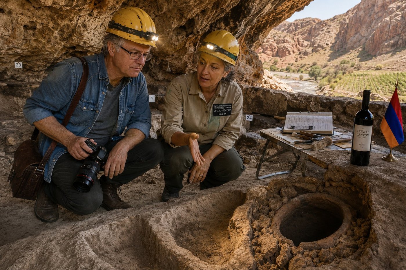
Areni-1 Cave — Oldest Winery on Earth
Areni-1 — known to archaeologists simply as “the Bird’s Cave” — is the oldest known winery on Earth. In 2010, a team led by Boris Gasparyan of the Armenian Institute of Archaeology and Ethnography, alongside colleagues from UCLA and University College Cork, published their carbon-dated finding: a complete wine-making complex sealed beneath cave-floor sediments since around 4100 BC. A shallow stone basin where grapes were trodden by foot. A clay karas vat below, where the must fermented. Drinking cups. Grape seeds. Even desiccated grape skins of Vitis vinifera — the very same species that fills the glass tonight. The same cave also yielded, in a separate chamber, the oldest leather shoe ever found (3,500 BC) and dozens of ritually placed human skulls. The Vayots Dzor canyon was apparently doing a lot of things very early. Dr. Anahit, who walked me through the excavation with her headlamp tracing each numbered grid square, said that what surprises people most is not that Armenians were making wine six thousand years ago. It is that they have, in essentially the same valley, never stopped.
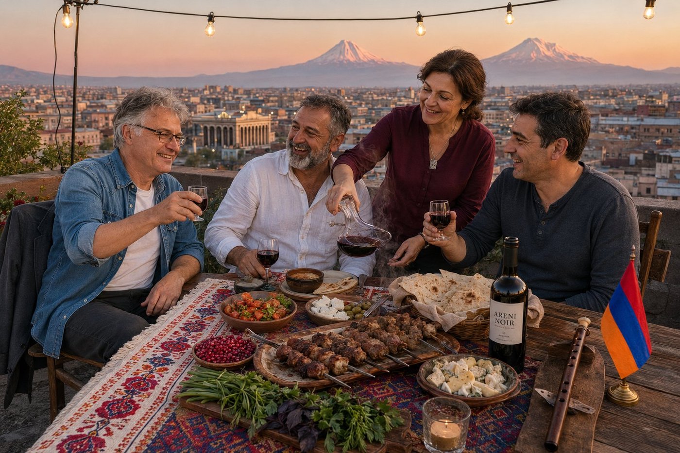
Khorovats on a Yerevan Rooftop
Khorovats — Armenian charcoal-grilled meat — is not really about the meat. It is about the table. The host that evening was Hovhannes, sixty-something with a salt-and-pepper beard and the elaborate hospitality you find everywhere east of the Bosphorus and increasingly nowhere west of it: a man who has decided the proper conclusion to a Saturday is to feed eight people for four hours on a Yerevan rooftop and refuse all assistance, in any form, from any of them. His wife Lilit poured. His friend Karen returned every toast. The lavash had been baked that morning in a clay tonir oven by his sister-in-law in the village. The tarragon and the basil and the dill had been picked from a balcony pot at the back of the building. The wine was an Areni Noir; the silver pendant Lilit wore was a tiny khachkar. Beyond the table, the pink-tuff buildings of central Yerevan caught the last of the day, and on the far horizon — sixty kilometres south, in territory no Armenian has freely walked since 1915 — the twin peaks of Mount Ararat lit up in the soft pink that Armenian painters have spent a thousand years trying to render. Hovhannes raised his glass for the last toast of the evening and said, in the formula that closes every Armenian dinner: “Կենացդ” — Kenats’d — “to your life, and to your living of it.”
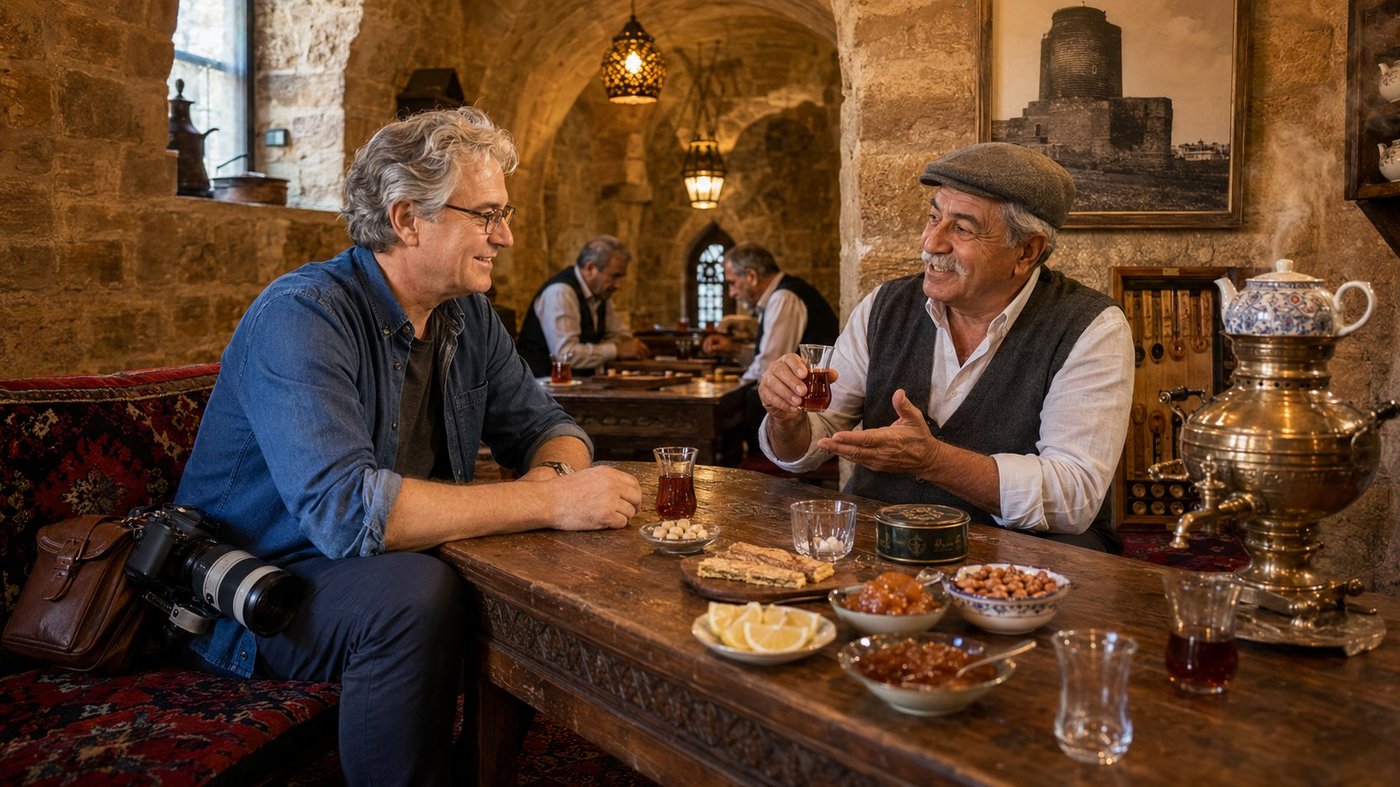
A Çay Evi in the Old City
An Azerbaijani çay evi — literally a “tea house” — is one of those institutions that does not so much serve tea as it serves a particular pace of being alive. There is no menu. The tea is brought continuously in small pear-shaped armudu glasses, by the waist, never by the body or the rim, accompanied by homemade preserves (quince, walnut, sour cherry, watermelon-rind) eaten by the small spoonful between sips, a small dish of sugar cubes to clamp between the front teeth, fresh lemon wedges, a bowl of roasted hazelnuts, a board of thin pastries. There is a brass samovar. There are always older men. There is always nard. There is no rush. Rauf Quliyev — for forty-one years a reporter for the daily Azərbaycan, now a retiree who has been a regular at this particular tea house for “longer than the current government has been a government” — picks up his glass by its narrow waist and tips it gently toward the lamp to show me the colour. “Always by the waist,” he says. “Never the rim, never the body. You will burn your fingers, you will spill your tea, you will look like a foreigner. Three failures at once.” He sips, sets the glass down, takes a small cube of sugar between his front teeth and sips again through it. “The form of this glass is not decoration. It is mathematics. The narrow waist keeps the heat in the body of the glass and lets the rim cool, so the first sip is exactly the right temperature.” He nods at the samovar between us. “The samovar is Russian. The tea is Indian and Sri Lankan. The glass is Azerbaijani. The conversation is whichever language the people speaking it have in common. This is also Azerbaijan.” Behind us, two retirees lean over a nard board and one of them gives a small theatrical groan; the other one laughs without looking up.
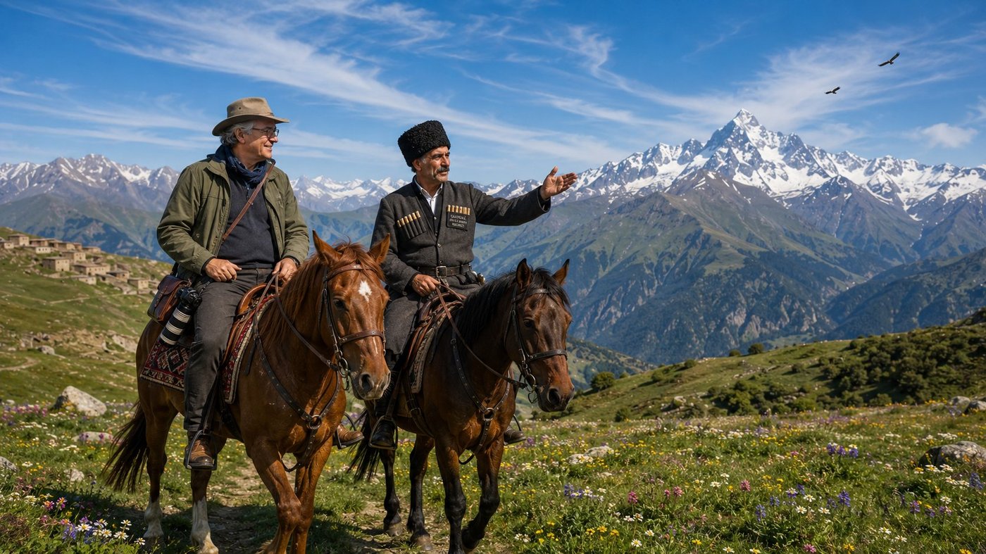
On Horseback above Xınalıq
There is a moment, on the upper trail above the village of Xınalıq in the Greater Caucasus of northern Azerbaijan, when the ridgeline opens out and Mount Şahdağ — four thousand two hundred and forty-three metres, the second-highest peak in the country — suddenly stands directly in front of you across a kilometre of alpine meadow, brilliant white against the cobalt sky, and the horse you are sitting on stops by itself, without being asked, because every horse on this trail stops by itself at this exact corner, because they have been doing this for at least a thousand years and they know perfectly well what the view is for. Murad Alxasov rides on my right and points across the meadow at the great white shark-tooth of Şahdağ. “My mother was born in that village down there in 1947,” he says, indicating with his chin the small fold of stone houses just visible behind us. “She speaks four languages — Khinalig, which is our language and ours alone, Azerbaijani, Russian, and a little Persian. Khinalig is spoken by approximately two thousand people on earth, all of us within walking distance of that house.” A small wind moves across the meadow and the wildflowers tremble. “Until 2006 there was no road up to the village. Everything came by horse — flour, salt, kerosene, schoolbooks, brides, doctors, the dead. The road was the most significant event of the twentieth century for us, after the war and the famine. We are still arguing about whether it was a good thing.” He smiles. “I think it was. My uncles think it was not.” His Karabakh mare snorts gently and shakes her head. “These horses also have an opinion,” Murad says. “They liked it better before the road. They had more work.”
🏝️ Oceania & Pacific8 photos · 3 countries
Sydney Opera House
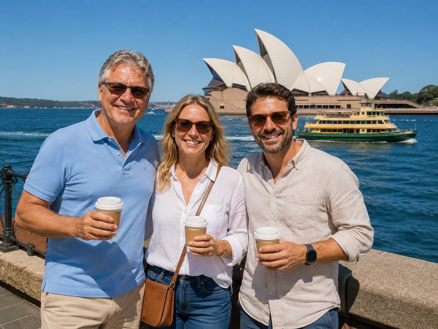
Jørn Utzon won the design competition in 1957, expected the project to take four years, and watched it stretch to fourteen — over budget, behind schedule, and so politically toxic he resigned in 1966 and never returned to Australia. The roof shells are sections of a single virtual sphere, a geometric solution Utzon arrived at while peeling an orange. The Opera House opened in 1973 without him. He was reinstated, in absentia, as the building’s official architect in 1999. The world eventually catches up.
Uluru at Sunset
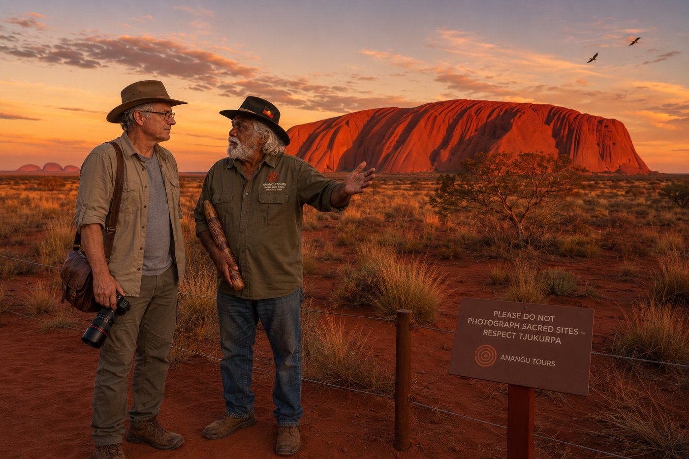
Uluru is 348 metres high, 9.4 kilometres in circumference, an estimated 550 million years old, and almost entirely underground. What you see is the tip of an enormous arkose sandstone formation that extends approximately 2.5 kilometres beneath the surface; iron oxidation gives it the red; differential erosion gives it the vertical ribbing. But the geology is the smallest part of the story. To the Anangu — the Pitjantjatjara and Yankunytjatjara peoples whose ancestors have lived in this country for at least 60,000 years, the oldest continuous human culture on Earth — Uluru is the physical record of Tjukurpa, the foundational creation events of the Dreaming. Every fold, every cave, every waterhole on the rock is the trace of a specific ancestral being doing a specific action. The rock is not a symbol of these stories. It IS the stories, physically present. In 1985 the Australian government returned legal title of Uluru to its Anangu traditional owners; in 2019, climbing the rock was permanently banned. William Tjapaltjarri took me out to Mutitjulu an hour before sunset, asked me politely not to photograph the designated sacred sites, and let the rock speak for itself. The eight-minute sunset transition from red to deep blood-crimson to indigo silhouette is, he said quietly, the closest thing the Anangu have to a public liturgy. I have stood in front of the Taj Mahal at sunrise, the Sphinx at noon, Notre-Dame at dusk. I have never been in front of a place that did this to the silence around it.
Great Barrier Reef — Lady Elliot Island
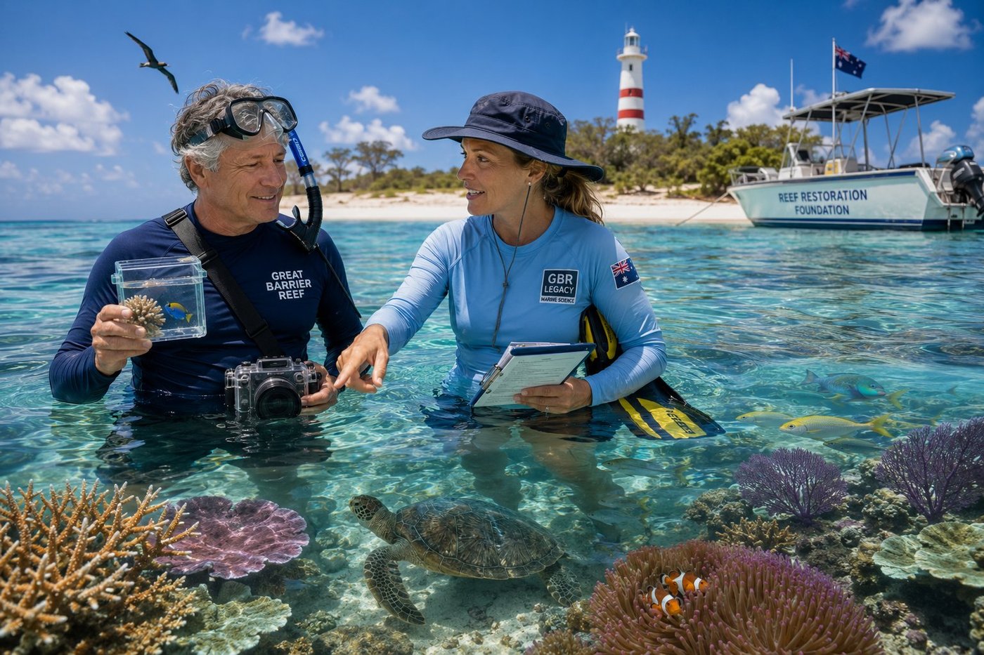
The Great Barrier Reef is the largest living structure on Earth — a 2,300-kilometre lattice of 2,900 individual reefs and 900 islands along the Queensland coast, visible from low Earth orbit, declared a UNESCO World Heritage site in 1981. It is also, in 2026, the most intensively monitored marine ecosystem in human history: between 1995 and 2022, the reef lost approximately half of its hard coral cover to four major bleaching events driven by sea-surface temperature anomalies, and the survival of the entire system over the next century is contested among the scientists who actually work it. Lady Elliot Island, at the southern tip of the reef system, is the most southerly coral cay and one of the healthiest remaining sections — a small 45-hectare island that hosts an eco-resort, a research station, an 1873 lighthouse, the densest manta-ray population on the GBR, and a small permanent staff of marine biologists working on the most ambitious reef-restoration program in the world. Dr. Hannah Fraser took me out into the lagoon that morning, handed me a specimen viewing-box and a clipboard, and let me follow her on a transect survey of a single twenty-metre stretch of healthy reef. In the span of one slow swim I counted forty-three species of fish, eleven species of hard coral, two species of soft coral, one green sea turtle, two clownfish couples, and a sleeping white-tipped reef shark on the sand. “It is the most extraordinary place on the planet,” she said when we surfaced. “And it is dying. And we cannot, any of us, look away from that.”
Margaret River Cabernet at Kavanagh Estate
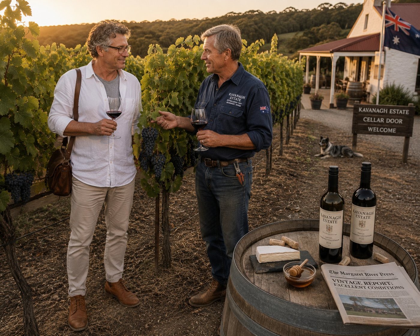
Margaret River is the most isolated major wine region on Earth — a 1,500-square-kilometre strip of Mediterranean-climate farmland on the south-western tip of Australia, surrounded on three sides by the Indian Ocean, four hours’ drive south of Perth, and producing only 3 percent of Australia’s wine by volume but roughly 20 percent of its premium-bottle-price-point wine. The region is comparable to Bordeaux’s gravel-and-clay soils and sits at almost exactly the same latitude as Stellenbosch in South Africa. It was first identified as a great viticultural location in 1965 by a single visionary named Dr. John Gladstones, in a scientific paper that read almost exactly like a treasure map; the first commercial vineyard was planted in 1967, and the region’s reputation today rests on the Cabernet Sauvignon and Chardonnay grown along its central ridge. Tom Kavanagh and his late wife Eileen planted their first 8 hectares of Cabernet in 1987, sold their first vintage in 1991, and have been making wine on this small ridge between the Margaret and Wilyabrup rivers ever since. The 2018 vintage we tasted that afternoon — five years old, just entering the early plateau of its drinking window — was one of the cleanest, most balanced Cabernets I have had outside of Pauillac. Tom poured a second glass for both of us, looked out at the row he had planted thirty-nine years before, and said, in the patient flat-vowelled cadence of country Western Australians: “Mate, this is the best office in the world. Don’t tell anyone.”
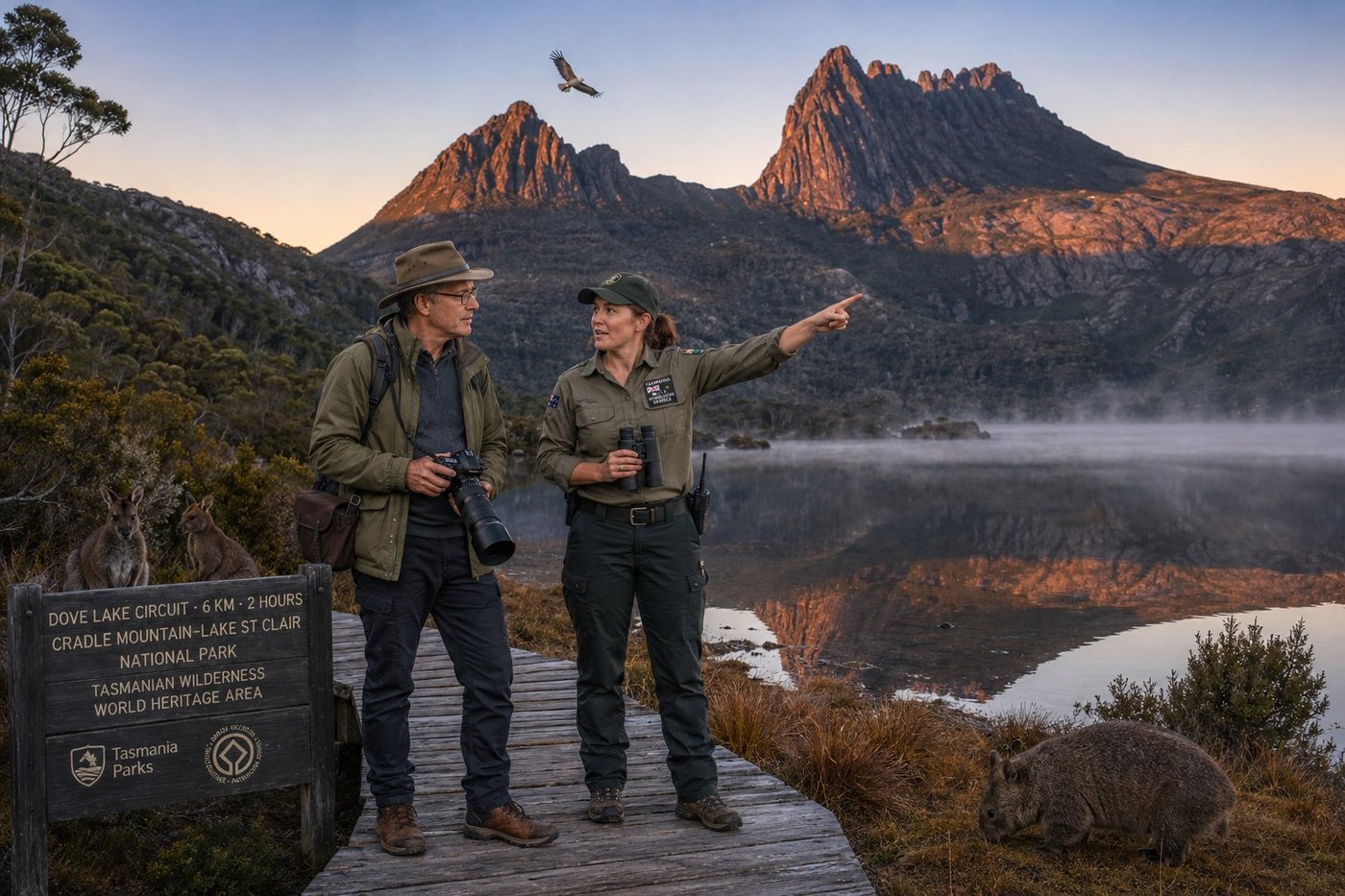
Cradle Mountain & Dove Lake at Sunrise
Cradle Mountain is 1,545 metres high, made of dolerite — the same rock as the Giant’s Causeway in Northern Ireland and the Palisades along the Hudson River — and rises with two distinctive jagged buttresses from the southern shore of a small alpine lake formed during the last glaciation. It is the most iconic landscape in Australia’s most overlooked state. Tasmania, the island off the south-eastern corner of the continent, is roughly the size of West Virginia and home to just 570,000 people; almost 50 percent of its area is protected as some form of conservation reserve. The Tasmanian Wilderness World Heritage Area covers nearly a quarter of the island and protects one of the last large temperate wilderness ecosystems on Earth — including cool-temperate rainforest of plants whose evolutionary cousins are found in Patagonia, New Zealand, and Antarctica: living remnants of the Gondwanan supercontinent that split apart 180 million years ago. The Dove Lake Circuit is six kilometres of boardwalk-and-track that loops the lake at the foot of the mountain. Doing it at sunrise, before the daytrippers arrive from Launceston, means having the most photographed reflection in Australia largely to yourself. Sarah took me out at 5 a.m. from the Ronny Creek shuttle stop, and we walked in silence to the boardwalk by the lake just as the first light caught the peaks. She pointed out the wombat — Tasmania has the densest wombat population in Australia — and the pair of Bennett’s wallabies grazing on the foreshore, and the sea-eagle. “On a still morning like this,” she said quietly, “the lake is the mirror and the mountain is the face. It’s one of the only places I know where the country looks at itself.”
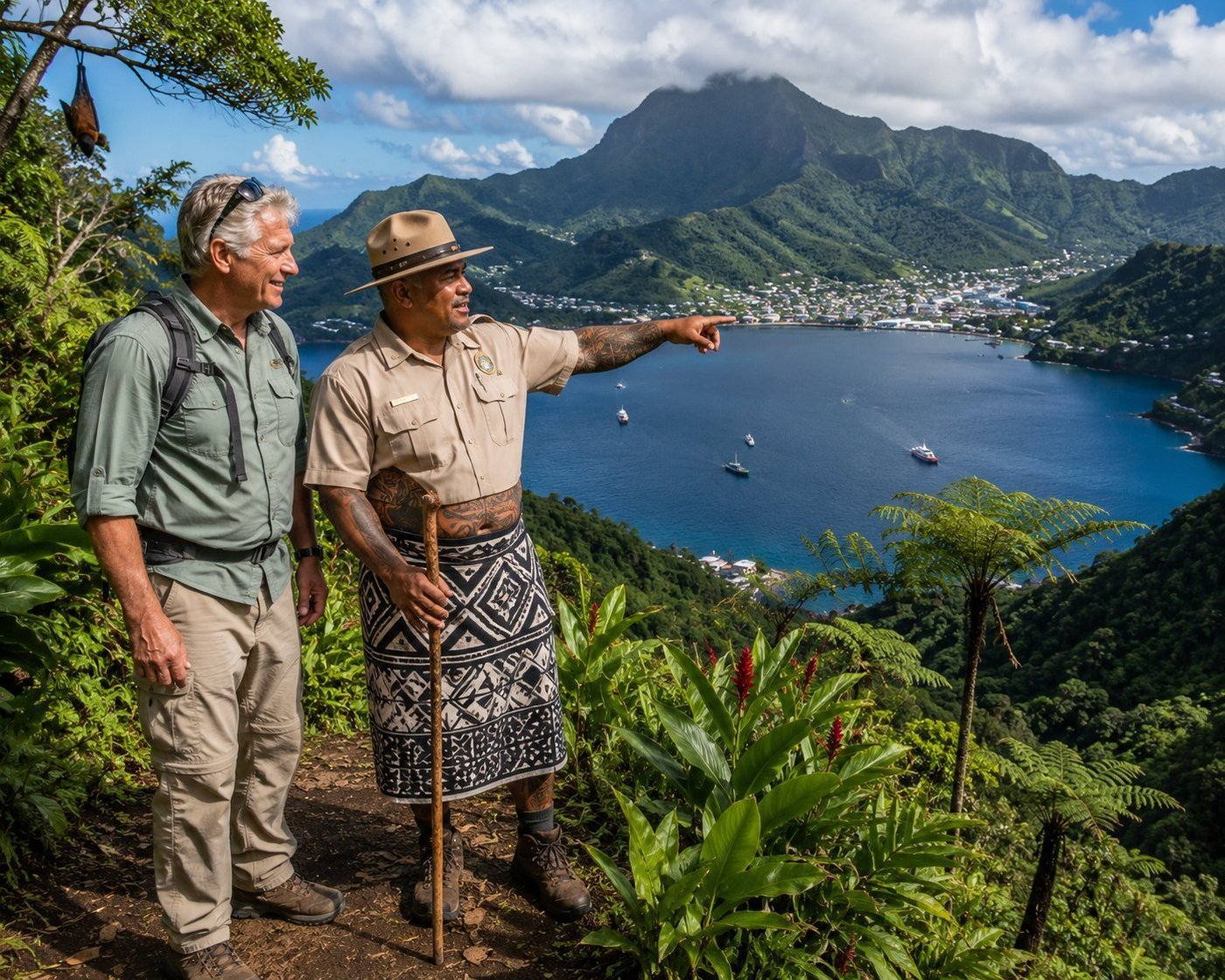
Pago Pago Harbor · Mount Alava
Pago Pago Harbor is one of the most dramatic natural harbours on Earth — a volcanic caldera breached by the sea, four kilometres long, flanked by ridges of dense tropical rainforest rising almost vertically to 500 metres. The National Park of American Samoa is the only U.S. national park south of the Equator and the least visited — about 30,000 people a year, against the four million who visit the Grand Canyon. American Samoa has been a U.S. unincorporated territory since 1900, but has stayed more Polynesian than American in all the ways that matter. My guide, Tuilagi, is both a park ranger and a matai — a traditional chief. The pe’a tattoo covering his thighs marks his rank. He explained that the flying fox bats roosting in the trees are not just protected wildlife but cultural symbols: pe’a vao, "forest bats," whose flight is said to carry the prayers of one’s ancestors. The harbour was the only Pacific port large enough to host the entire U.S. fleet during World War II. Today it hosts mostly fishing boats. The forest is largely indifferent to both.
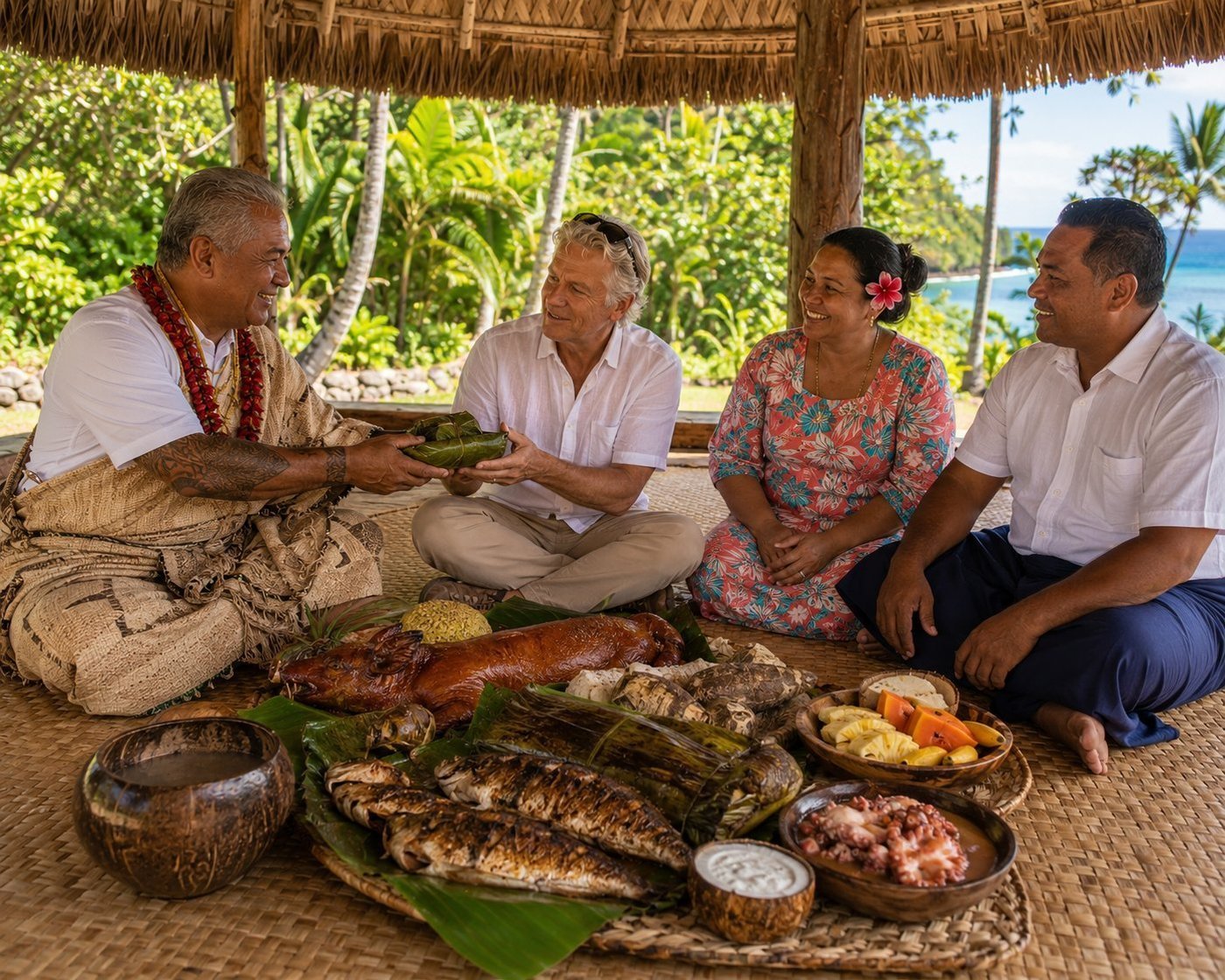
A Sunday Fia Fia Feast
Fa’a Samoa — "the Samoan way" — is the unwritten constitution that has governed Samoan life for at least three thousand years. It is built around three things: the extended family (aiga), the chiefly authority (matai) elected by each family, and Sunday. Every Sunday after morning church, every Samoan family gathers for the great communal feast prepared the traditional way: in an umu, an earth oven of heated volcanic stones laid in a pit, covered with banana leaves, and slow-roasted for three hours. Setiola, the matai of the family I sat with, presides over an extended aiga of about forty people. The food was extraordinary: whole snapper baked in banana leaves, roasted suckling pig, taro, breadfruit, octopus in coconut cream, and — the unrivalled centerpiece — palusami, parcels of young taro leaves baked in coconut cream until they become something between a custard and green velvet. His wife, who insisted on calling me uso — brother — kept refilling my coconut shell with water. The trade wind passed through the fale. There was no hurry to be anywhere else.
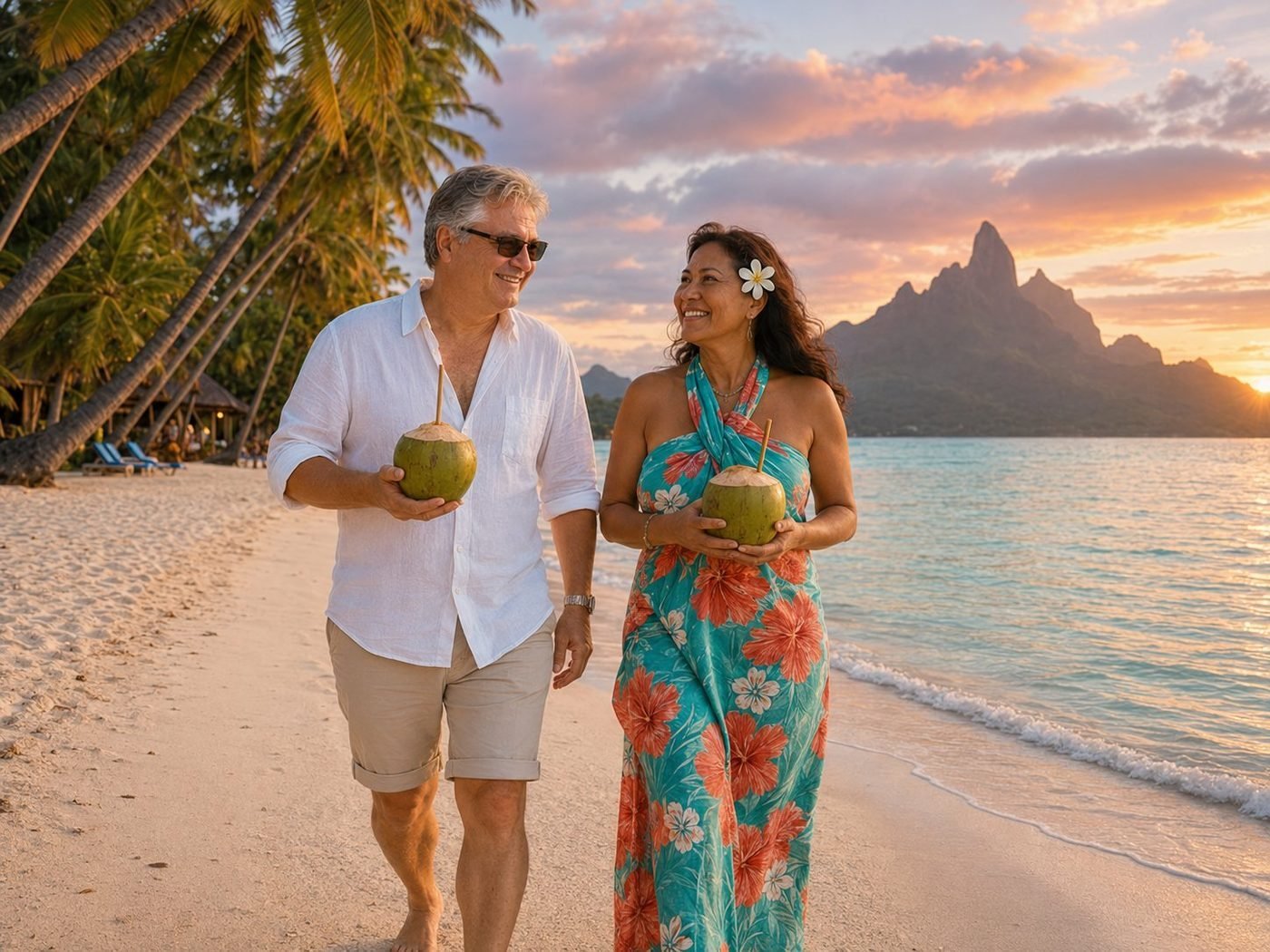
Coconuts at Sunset
Bora Bora is a single volcanic peak — Mount Otemanu, 727 metres of basalt — surrounded by a coral lagoon and a shallow blue ring of barrier reef. The whole island can be circled by bicycle in three hours. The tiare flower behind a Tahitian woman’s ear is the local greeting, more reliable than a wave. The coconut water came straight from the fruit, hacked open with a machete by the man at the beach bar. He recommended drinking it before we walked. He was right.
🌍 Africa7 photos · 4 countries
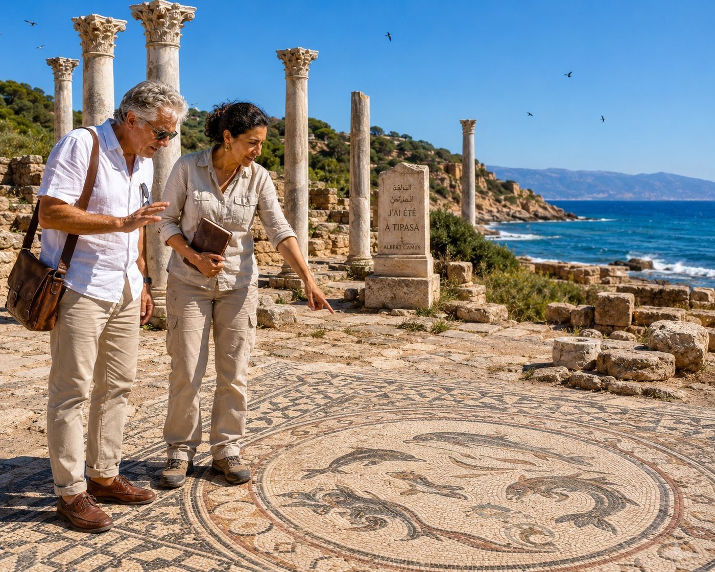
Tipasa · Where Camus Wrote
Tipasa is a small Phoenician harbour that became a major Roman provincial city, then a Christian basilica town, then a ruin — and finally, through one of the most famous essays of 20th-century French literature, a place of pilgrimage. Albert Camus, born in French Algeria in 1913, wrote Noces à Tipasa here in 1936: a young writer’s pagan-classical meditation on sun, sea, ancient stones, and the right to be happy without reason. The essay made Tipasa famous in French letters. A small carved stele still stands in the ruins bearing his line: I understand here what they call glory: the right to love without measure. The Roman city itself was substantial — basilica, forum, theatre, villas with mosaic floors that have miraculously survived 1,800 years of Mediterranean weather. UNESCO listed the whole site in 1982. My guide, Yasmina, has been working at the site for fifteen years. She showed me which mosaic had been excavated when, and which view across the bay had inspired which paragraph of Camus’s essay. We sat for a moment in the shade of a fallen Corinthian capital, the sea below us in the same blue Camus wrote about. Some places make their own argument for being preserved.
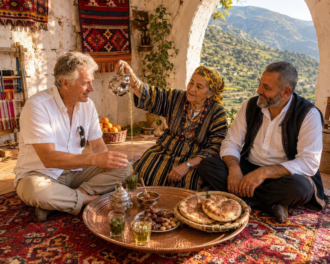
A Berber Tea Ceremony
The Kabyle Berbers — Iqbayliyen — are one of the largest Berber peoples in North Africa, with around five million speakers of their language Taqbaylit. They live mostly in the rugged Djurdjura Mountains east of Algiers, a region that has resisted assimilation in turn by Romans, Arabs, Ottomans, and the French. The villages are whitewashed stone, perched on ridgetops; the language is still alive; the women still weave the bright red-and-ochre wool rugs that have made Kabyle weaving famous for centuries. The tea ceremony itself is small choreography. The pot is brought to a boil; the green tea is steeped; fresh spearmint and sugar are added; the tea is poured from height into small glass cups, several times — each pour aerates the liquid into the proper foam (relqaa), the sign of correct preparation. Three rounds are served: the first bitter as life, the second sweet as love, the third gentle as death. The afternoon I sat with Tassadit and her son Rachid in their courtyard above the village of Aït Hichem, the mountain wind moved the woven hangings on the walls. She speaks only Tamazight; her son translated. She told me I should come back in the spring when the cherry trees bloom. I plan to.
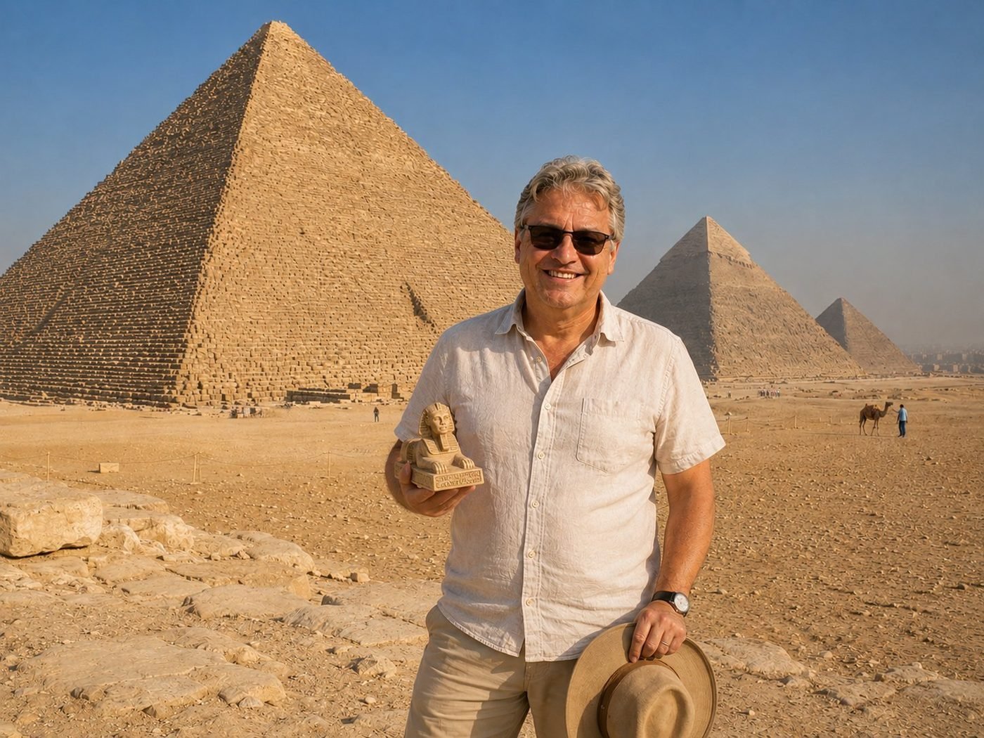
The Pyramids of Giza
The Great Pyramid of Khufu is 4,500 years old, was the tallest building on Earth for 3,800 of those years, and we still don’t fully agree on how it was built. Two and a half million blocks, average weight two and a half tonnes, aligned to true north within a tenth of a degree, in the middle of a desert. Whatever quibbles one has about ancient labour conditions, the engineering is undeniably world-class. The pharaoh statuette in my hand cost five dollars at the gate. The pyramid behind me cost roughly the GDP of Egypt at the time. Both are valid souvenirs in their way.
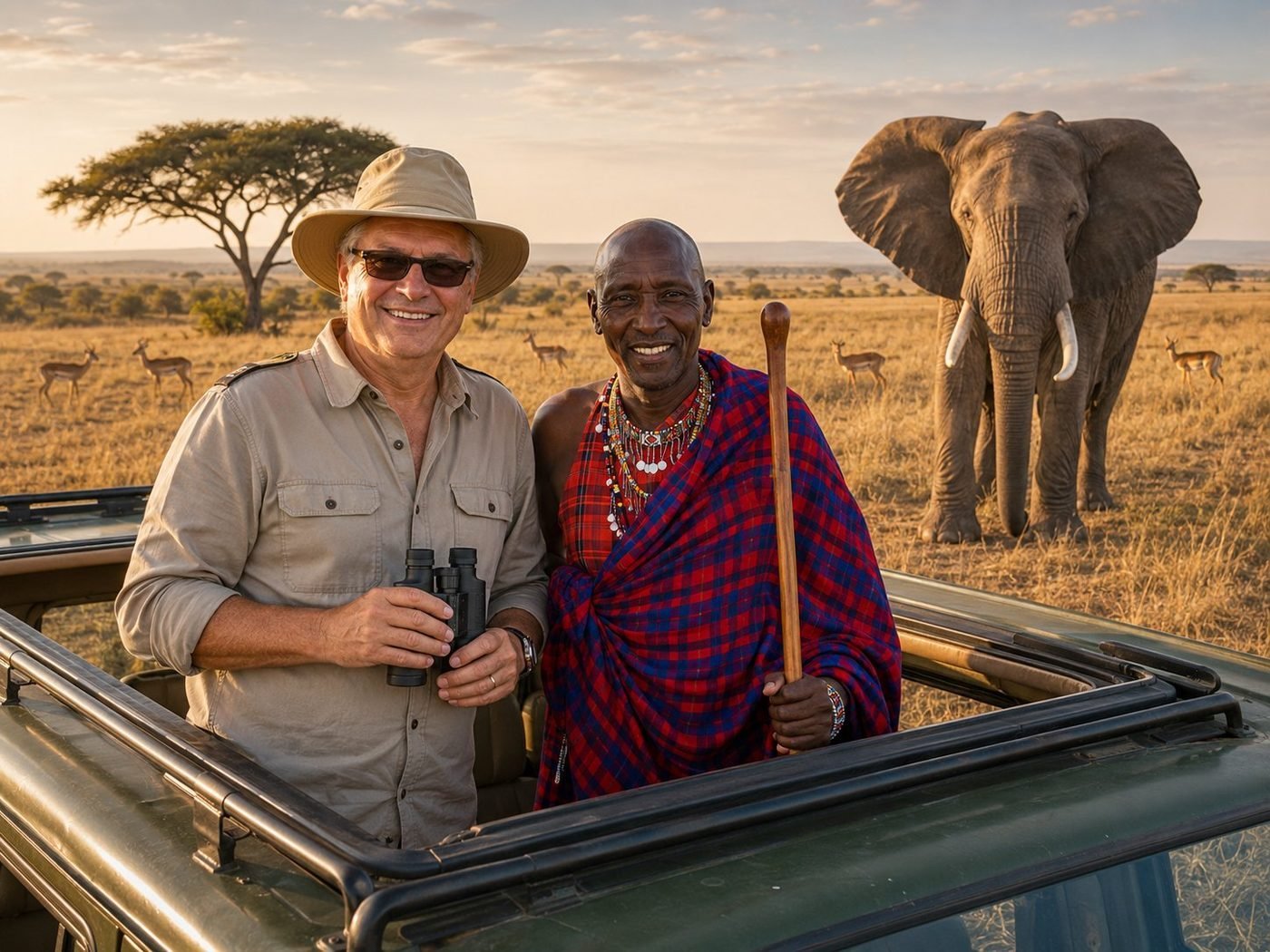
On the Mara · with a Maasai guide
The Maasai are a Nilotic pastoralist people who have shared these plains with the elephants and impalas for at least four centuries — possibly much longer. The red shuka cloth is partly tradition, partly a deliberate signal to wildlife: lions associate the colour with humans and avoid it. Our guide spoke six languages, including English, Maa, and enough French to handle the cruise-ship crowds. The elephant behind us is a bull, about thirty years old. We stayed inside the vehicle because he was paying close attention.
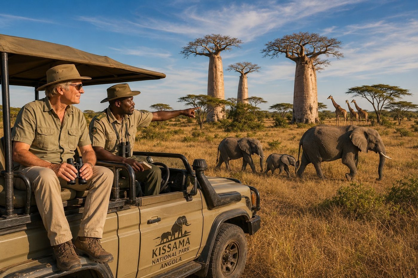
Kissama · Operation Noah’s Ark
The Kissama National Park sits 70 km south of Luanda along the Kwanza River, covering nearly 10,000 km² of savannah, wetland, and baobab forest. For most of the 1980s and 1990s — the long Angolan civil war — it was a battlefield, and almost the entire population of elephants, giraffes, and large antelope was lost to poaching and conflict. Then, in 2000, came one of the most ambitious African conservation projects ever attempted: Operation Noah’s Ark, a multi-year effort to airlift surplus wildlife from Botswana, South Africa, and Namibia and re-establish the populations. They flew in elephants. They flew in giraffes. The animals settled, bred, survived. The elephant family we watched — a matriarch with two juveniles and a tiny calf — were probably grand-grand-grand-descendants of an elephant flown in from Okavango in 2001. The baobabs were already old. They had been waiting.
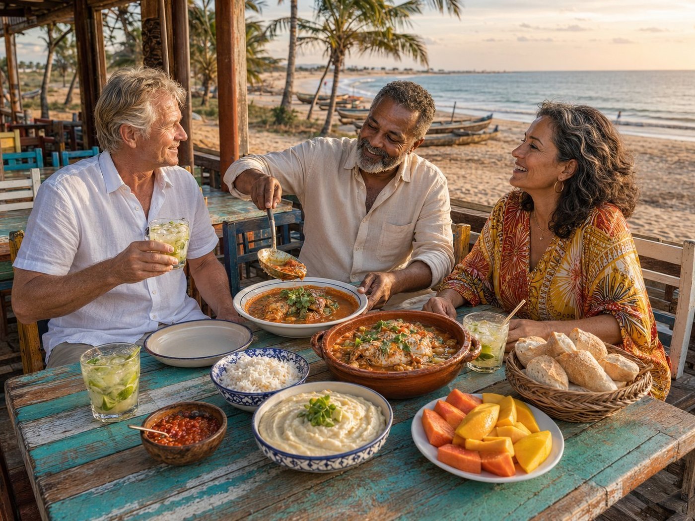
Mussulo · Moqueca on the Atlantic
The Angolan kitchen is one of the great unsung cuisines of the African Atlantic. Five hundred years of Portuguese colonial cooking met five thousand years of West African and Bantu food culture, and then crossed the ocean to Brazil and crossed back again — picking up techniques from both shores. Moqueca de peixe is the centerpiece: a slow-simmered whole fish in a rich orange stew of coconut milk, tomato, dendê (red palm oil), bell pepper, and cilantro, served with pirão — a cassava-flour porridge made by stirring the stew broth into manioc flour until it thickens. Caipirinha angolana, the Brazilian classic made with local cane rum, washes it down. António and Carlota run a small beach restaurant in Mussulo, a sandy peninsula reached only by boat from Luanda. He fishes; she cooks. They explained that the recipe for moqueca was carried to Brazil by enslaved Angolans in the 17th century, then carried back by Brazilian musicians and exiled writers who came to Luanda after independence. Some recipes refuse to forget where they started. This was one of those meals.
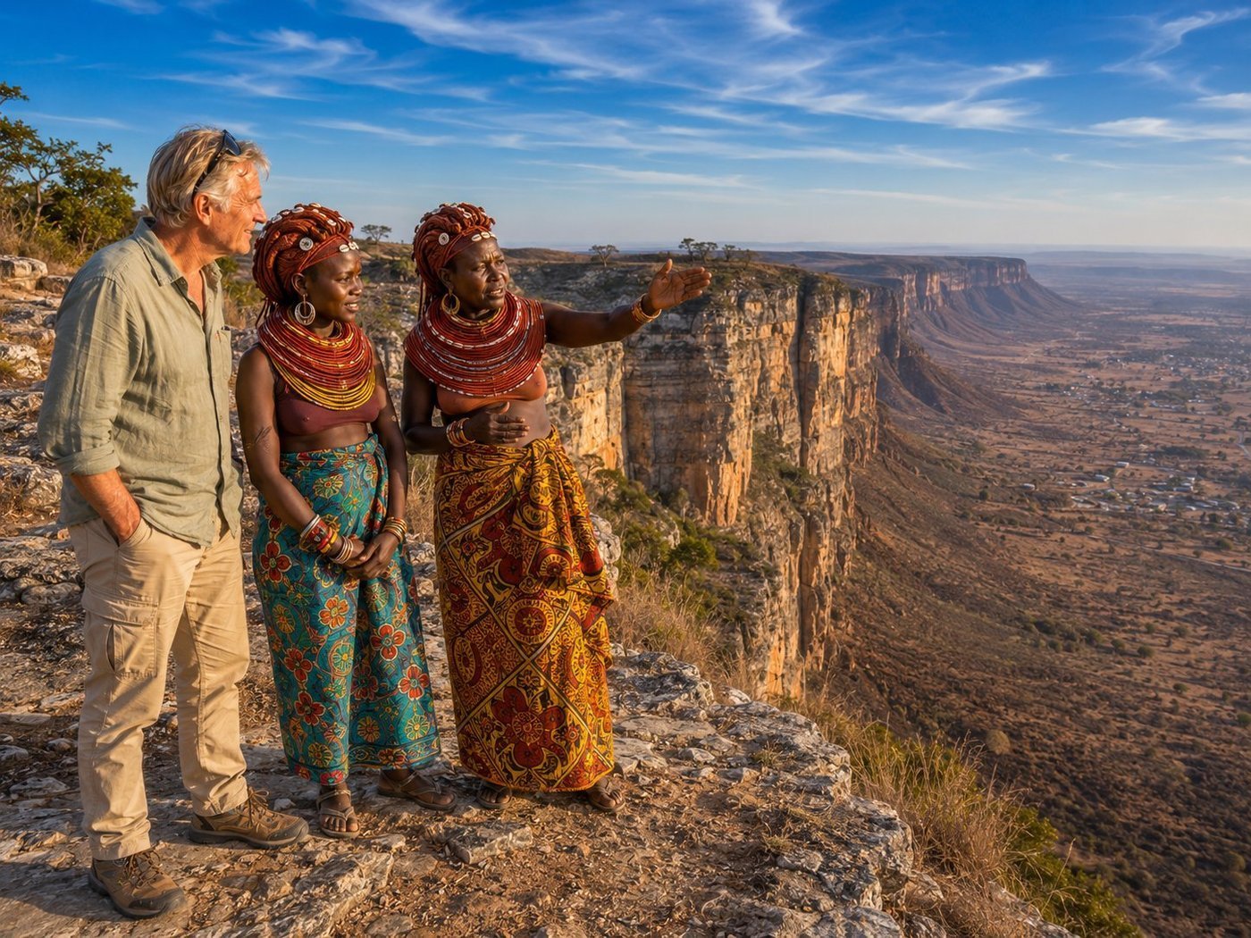
Tundavala · the Lookout of the World
The Tundavala Gap is a sudden, almost violent break in the high plateau of southern Angola: the land drops 1,200 metres in a vertical sandstone escarpment, plunging from the 2,200-metre Serra da Chela mountains into the dry Namib lowlands below. The local name Tundavala means roughly "the Lookout of the World," and the name is not metaphorical. From the rim, on a clear afternoon, you can see for a hundred kilometres into nothing. The Huíla highlands are home to the Mwila (or Muíla) people, a Nyaneka-speaking semi-nomadic group whose women maintain one of the most striking traditional adornment styles in Africa: hair worked with oncula — a reddish paste of ochre clay, cow butter, ground tree bark, and herbs — braided into sculptural locks decorated with seashells and silver medallions; vilanda neck collars layered over years and never removed. Yamuhile, the elder beside me, has worn her vilanda for forty years. She remembers the Portuguese; she remembers the war; she remembers what the escarpment looked like before there were any roads to it. She also speaks five languages. Some of the most sophisticated people in the world live in places no one has heard of.
🇦🇶 Antarctica4 photos · 1 territory
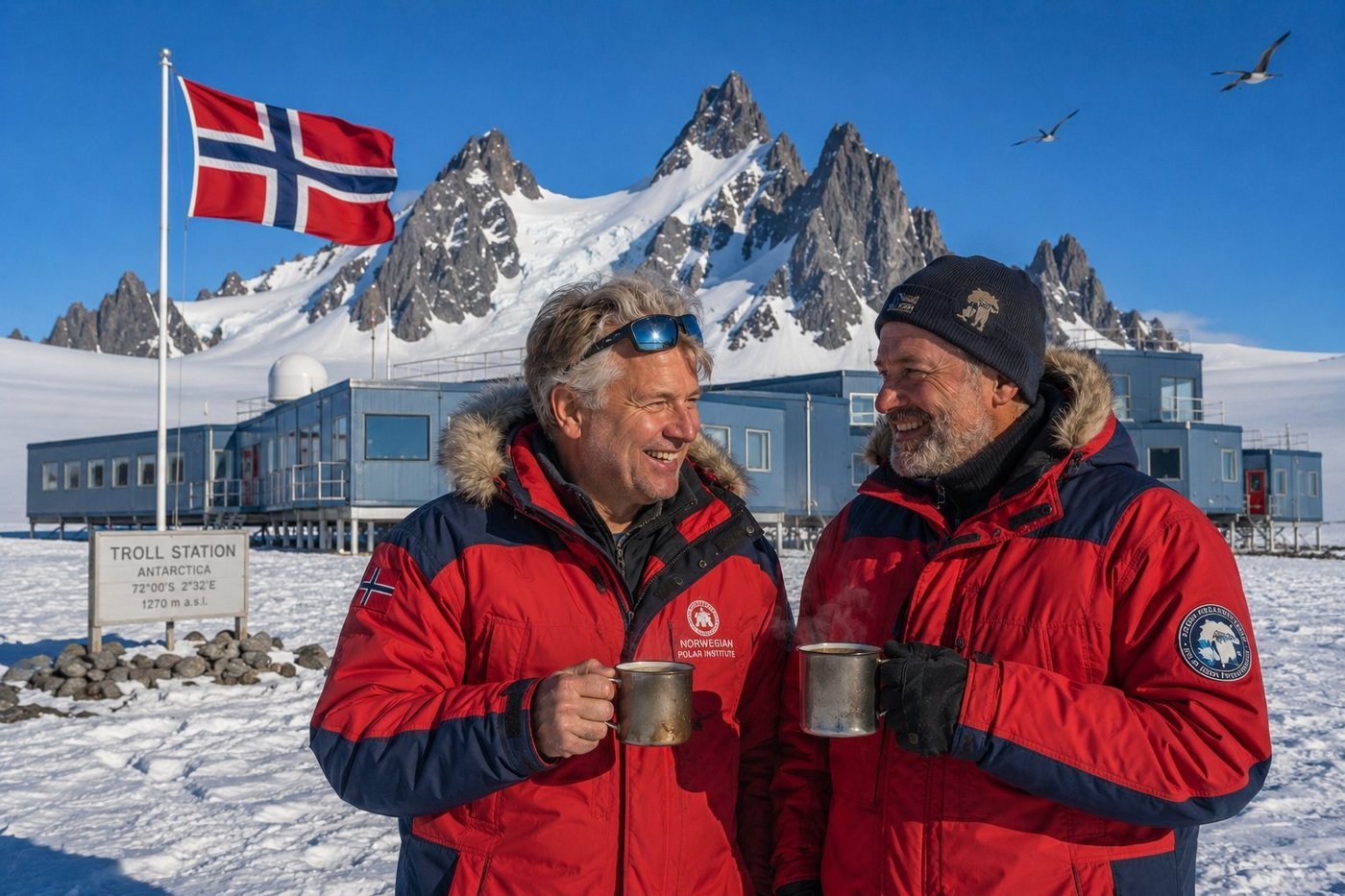
Troll Station · Norway's Antarctic Base
Troll is Norway’s year-round Antarctic research station, planted 235 kilometres inland on a granite nunatak called Jutulsessen at 1,270 metres elevation — in the heart of Queen Maud Land, the slice of Antarctica that Norway has claimed since 1939. Run by the Norwegian Polar Institute, it has been operating continuously since 2005, housing six to eight staff through the long polar dark and up to forty-five during the brief austral summer: glaciologists, climatologists, atmospheric chemists, and the technicians who keep the adjacent Troll Airfield clear for the LC-130 Hercules flights connecting this place to Cape Town. Lars, a 50-something Norwegian glaciologist on his seventh season at Troll, told me over a mug of strong black coffee that the thing nobody warns you about is the silence — a kind of pressing acoustic emptiness broken only by the wind, the distant diesel hum of the generator hall, and the occasional cry of a South Polar skua wheeling above the nunatak. The granite spires of Jutulsessen behind us are 1.1 billion years old: among the oldest exposed rock on the continent. Coffee at the end of the world. The Norwegians have known how to do this for a long time.
Lemaire Channel · “Kodak Gap”
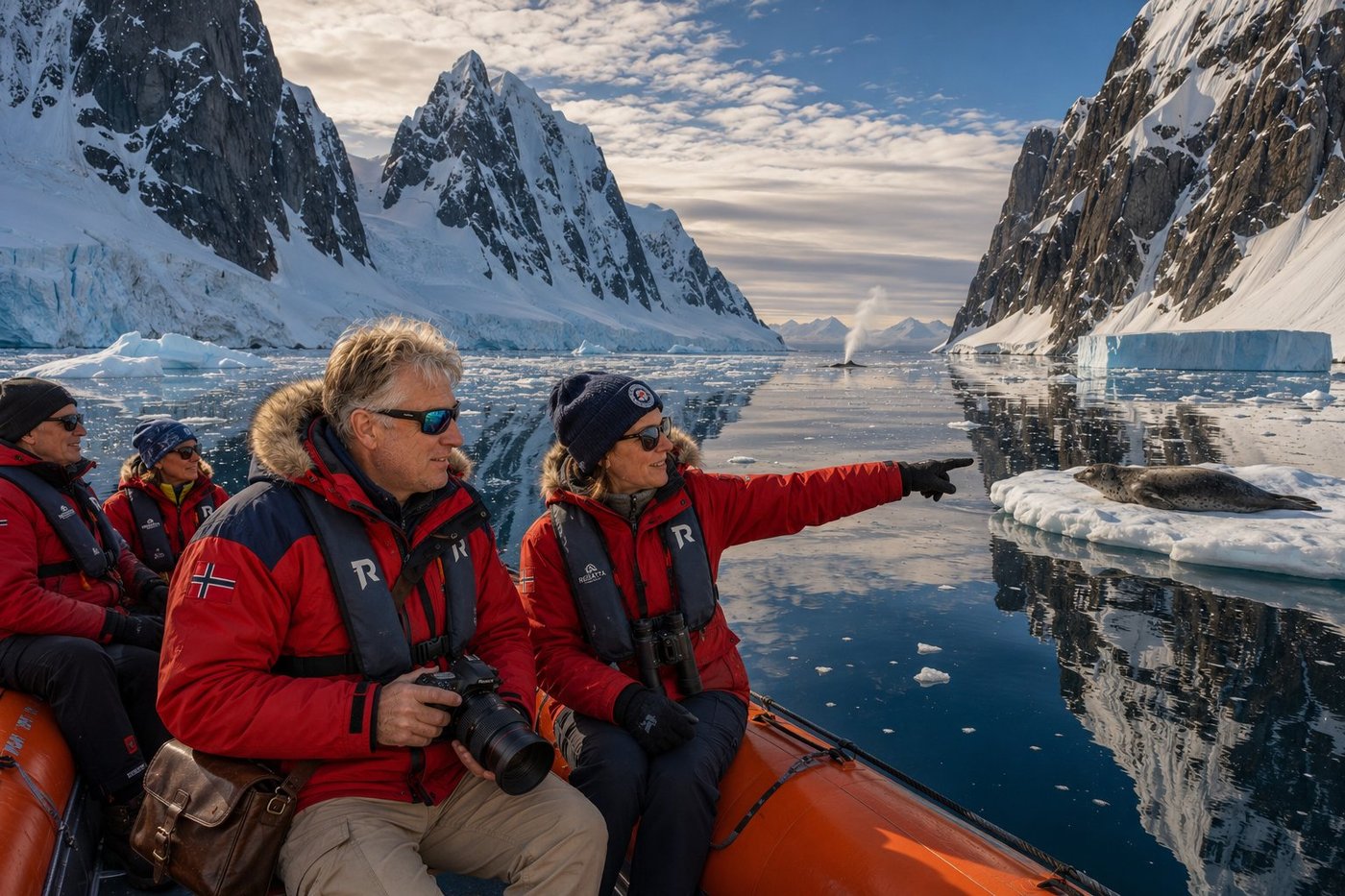
The Lemaire Channel — known to expedition skippers as “Kodak Gap” for the sheer density of photographers it produces per square nautical mile — is an 11-kilometre-long, 1.6-kilometre-wide strait between the Antarctic mainland and Booth Island, on the west side of the Antarctic Peninsula. The walls of dark rock and ribbed glacier ice rise sheer on both sides to a thousand metres; the water below is a deep blue-black so still it mirrors the walls perfectly. We slipped through in the early evening light, four to a Zodiac, with our expedition guide Astrid — a former Norwegian Polar Institute biologist on her twenty-third Antarctic season — pointing out a Weddell seal hauled out on a small ice floe directly in our path. (Weddell seals are the southernmost-breeding mammal on Earth and the most placid of the Antarctic phocids; the Zodiac drifted close enough for a photograph without disturbing it.) A humpback spout exhaled twice in the distance. Astrid said, with the dry detachment of someone who has watched this channel a thousand times, that there are people who come here once and spend the rest of their lives trying to come back. I understand them now.
Port Lockroy · The World’s Southernmost Post Office
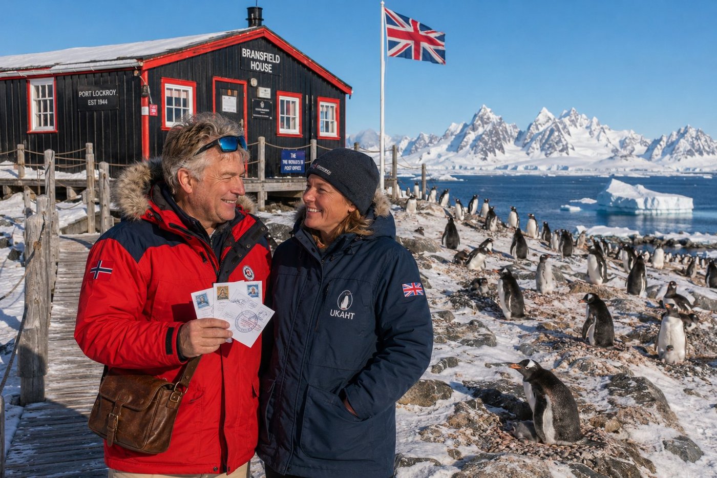
Port Lockroy is the most famous small building in Antarctica. Bransfield House — the gable-roofed black-and-red wooden hut on the rocks of Goudier Island — was built in 1944 as part of Operation Tabarin, the British wartime mission to assert sovereignty in the South Atlantic and watch for German raiders. After the war it became a regular British Antarctic Survey research station until 1962, then was abandoned to the ice for three decades. In 1996 the UK Antarctic Heritage Trust restored the original timbers, the linoleum floor, the wartime radio sets, the cans of Heinz baked beans still on the shelves, and reopened the hut as a museum, gift shop, and — improbably — a fully-functioning Royal Mail post office. Roughly 70,000 postcards a year are stamped with the Port Lockroy postmark and sent home from this small shed at 64°49′S. The other inhabitants of Goudier Island are about 1,500 breeding pairs of gentoo penguins who nest, with serene indifference, around and beneath the museum walls. Sophie, the British UKAHT volunteer who postmarked my three cards, explained that the post office is run by four women each austral summer, chosen from over 6,000 annual applicants. The job pays nothing. They count penguins, they sell stamps, they live without running water for five months. The waiting list, she said, is extraordinary.
Paradise Bay · Camp on the Ice
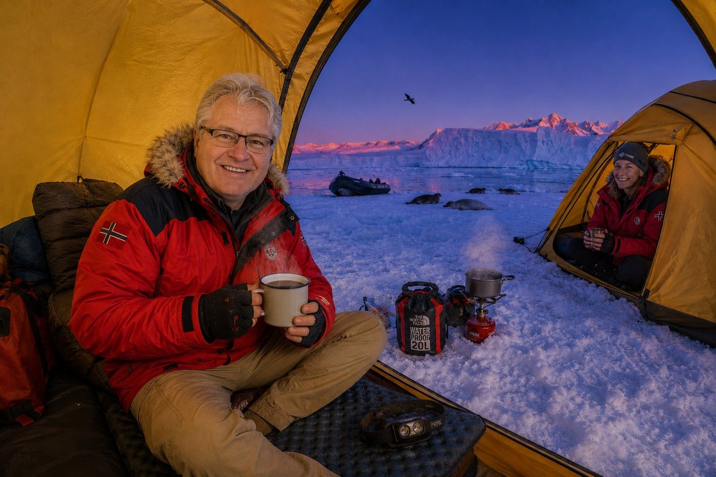
A small number of Antarctic expedition operators offer something called “polar camping” — a single overnight on the sea ice or on a snow bench ashore, away from the warmth and food and noise of the expedition ship, sleeping out on the continent itself. It is the closest most of us will ever come to an actual Antarctic expedition. We were briefed in the afternoon: no food in the tents (the skuas are clever and the giant petrels can lift a tent flap); no human waste left behind (we were each handed a sealed pee bottle and a sense of humor about it); no leaving the marked camp area after dark. Then we were ferried by Zodiac to a flat snow shelf above Paradise Bay, given a sleeping pad, a sleeping bag rated to –30°C, and a single small bright-yellow tent each, set up by the guides in a tidy line across the snow. The light that came across the bay at midnight, when the sun barely dipped below the southern horizon, was the most beautiful light I have ever witnessed: a slow purple-then-orange-then-rose alpenglow on the glacier walls, the water mirror-still, three crabeater seals sleeping on a floe a hundred metres out, a single skua patrolling the edge of the camp. Astrid, our guide, came to my tent door at about 11:30 p.m. with a small enamel mug of hot chocolate. Hers, characteristically, had a splash of Norwegian aquavit in it. “Don’t tell anyone,” she said, and toasted the horizon. I did not sleep all night. There was nothing on Earth more interesting than what was happening outside the tent.
All photographs above are from the personal collection of Radim Kaufmann and from the Kaufmann World Travel Factbook (www.kaufmann.wtf). Images have been digitally edited for presentation.